
We are able to do a mid-month update this month, so be sure to come back the end of the month for the remainder of the journey.
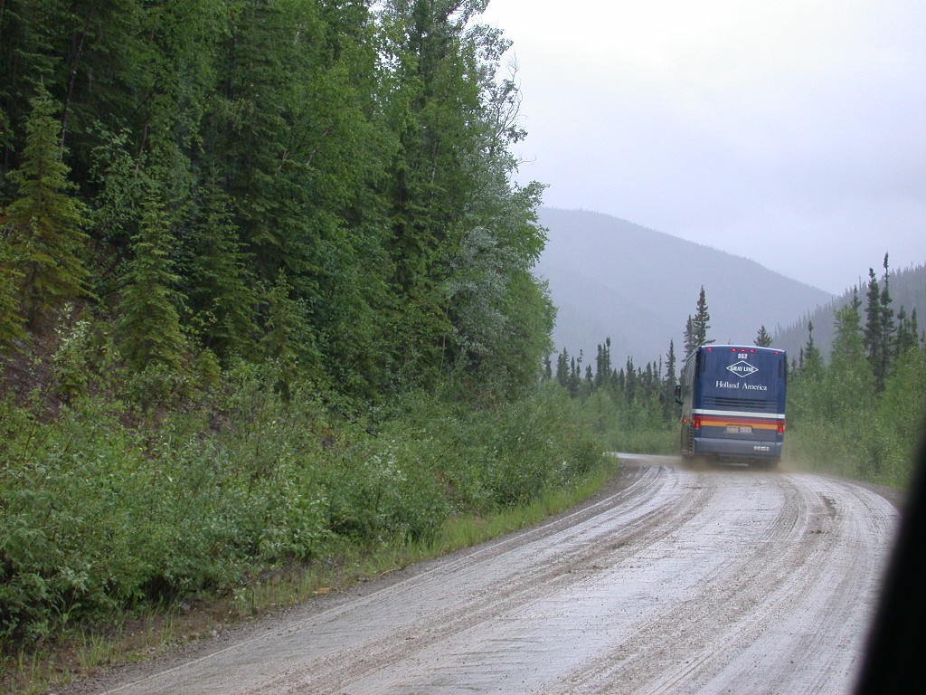
June 30 – It was sunny when we woke up this morning, but just as we finished hitching up, it began to rain. It was just a light rain, not as heavy as the day before. As we turned onto the Alaska Highway, there was a rainbow in front of us. We decided it was an omen of a good day ahead. We turned onto the Klondike Highway, heading north. This highway follows the path of the Yukon River, passing Lake Labarge, scene of Robert Service’s “Cremation of Sam Magee”.
Our first stop was Braeburn Lodge. We skipped breakfast in anticipation of this stop. Braeburn Lodge is famous for their cinnamon buns and we wanted to see if they met up to the hype. Wow! One bun can easily feed a family of 4. The bun completely covered a 9” paper plate and was about 4 inches tall. We got one, both of us ate off it, and we still had enough left over for another meal. We also got a couple of the peanut butter cookies, about six inches high and ½” thick. Just as we sat down to eat, 2 tour buses pulled into the lot, so we made it just in time to beat the rush.
After filling up our tummies, we continued north. The rain had stopped and it was sunny and turning into a pretty day. We passed through Carmack, a good agate hunting area, and crossed the Yukon River.
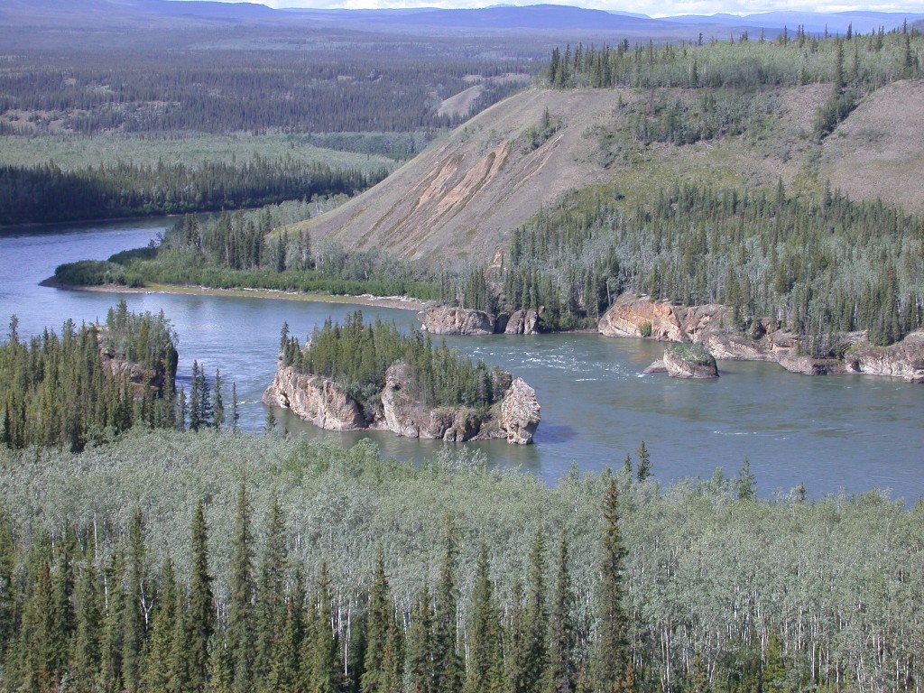
We stopped at the Five Finger Rapids overlook, a navigational hazard on the Yukon. There are rock pillars in the river and the early miners named the area as the river is split into 5 channels by these pillars. This was a major problem for the steamboats as the plied the river between Whitehorse and the Bering Sea. The boats were able to pass through by using the channel closest to the east bank of the river, going downstream. Going upstream, the boats were not powerful enough to get over the fast flowing rapids. In order to get past, there were lines attached to the bank and the boats were literally pulled through the rapids.
We passed the cutoff to go to the Mayo-Keno area, a big silver boom occurred in this area, after crossing the Stewart River. The road then climbed and we enjoyed a good view of the river. Our next river crossing was the McQuesten River, a tributary of the Stewart. Outside of Dawson City we crossed the Tintina Trench, which is the largest fault in North America.
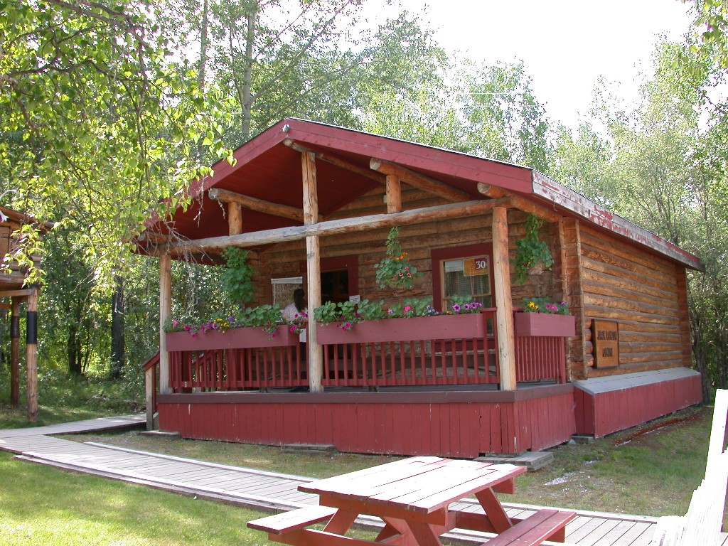
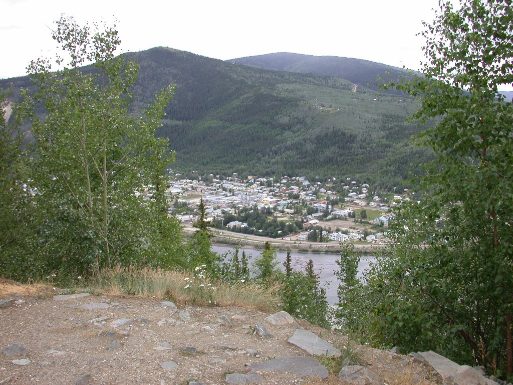
We arrived in Dawson City and checked into Bonanza Gold RV Park. Later in the day we drove into town, got diesel and looked things over some.
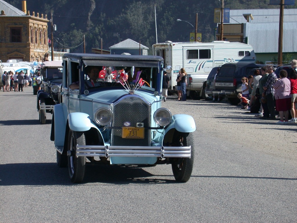
July 1 – Today is Canada Day, which is Canada’s Independence Day. We went into Dawson City for their parade. There were a lot of antique cars in the parade and Dick enjoyed seeing them. The parade was very short, 15 minutes or so.
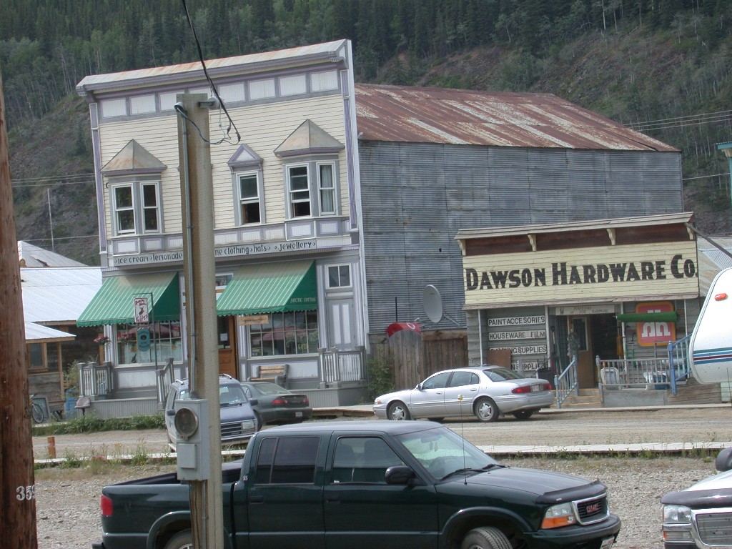
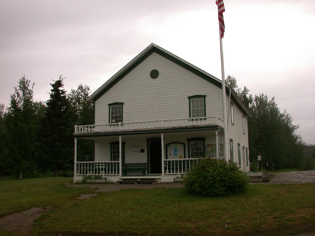
After the parade, we walked down Front Street, checking out the old buildings and the grocery store. We went to the Visitor’s Center, where we were given a schedule of the days events, plus schedules for Parks Canada attractions, etc. We then walked to the City Museum and went inside to see the exhibits. The museum building is a former government building, used when Dawson City was the capitol of the Yukon Territory. It is a very pretty building and upstairs is a beautiful courtroom that is still used. The museum has a lot of really good exhibits and we spent quite a while enjoying them. We also saw a film there, “City of Gold” that was excellent, explaining the city’s history and with many shots of the city in the 1970’s when it was nearly a ghost town.
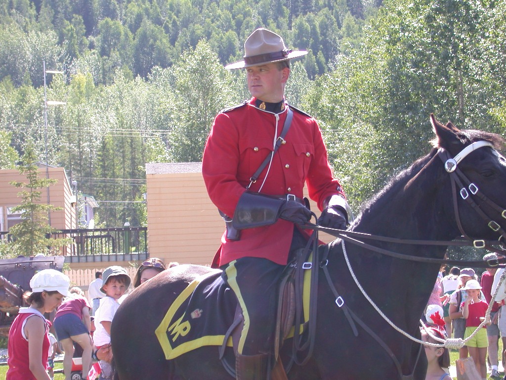
Outside the museum, many of the crowd had gathered for Canada Day ceremonies. Several Mounties were there, clad in their formal red coats, one was on the traditional horse. Modern day Mounties dress in traditional law enforcement uniforms and use cars for patrol. The Mountie detachment in Dawson City does provide the traditionally attired officer on the horse several times a day for folks like us to take photos.
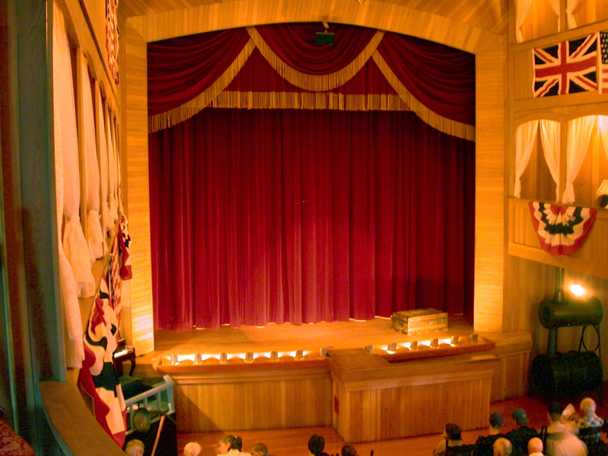
We stopped at the Palace Grand Theater and made our reservations for the “Gaslight Follies” for the next evening, then finished our walking tour of the town and headed back home.
July 2 – We have a busy day planned. We drove down to the visitor’s center and purchased tickets for 2 of Park Canada’s attractions.
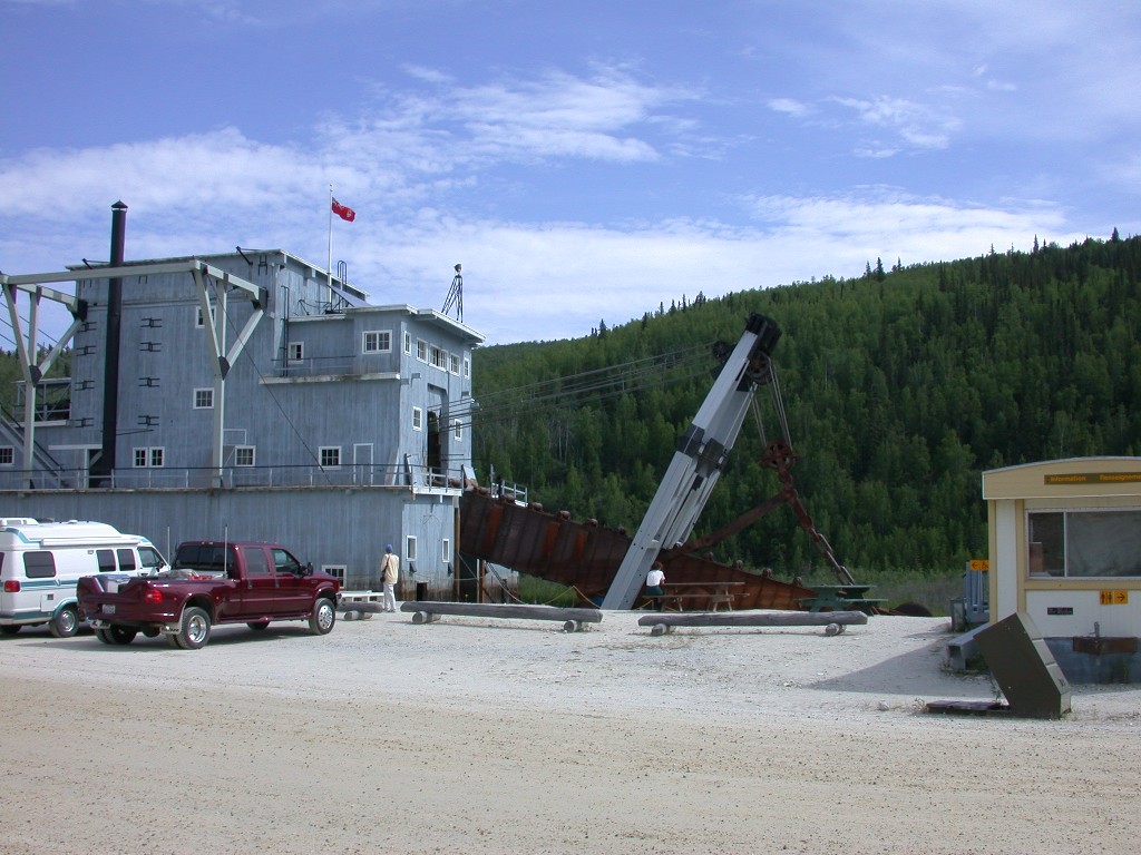
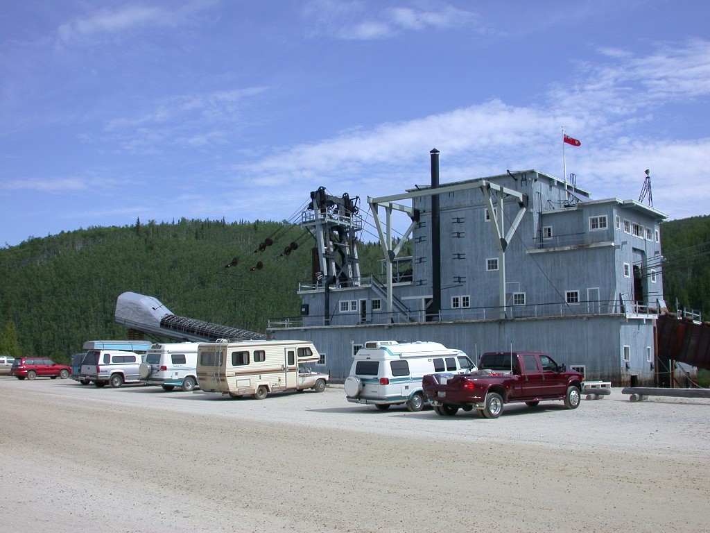
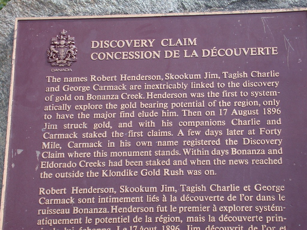
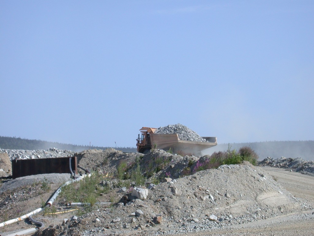
We first headed back out of town to Bonanza Creek, site of the first discovery of gold in the area, which started the great rush of 1896-1898. We toured Dredge #8 with a very knowledgeable young guide. These giant dredges were brought into the area in the 1900’s to rework the creeks, as they were able to recover gold that earlier mining methods left behind. These monster machines were floated on shallow ponds, and the buckets were on a continuous belt that scooped up the gravel from the creeks, filtered it for gold, then the waste gravel was sent by conveyer belt out the back of the dredge. The area around Dawson City is covered with this giant was piles of tailings, they look live giant caterpillars. Dredge #8 as one of the largest ever built.
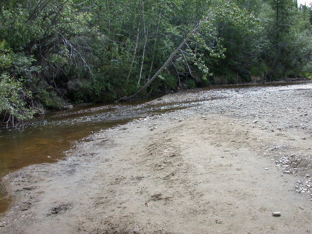
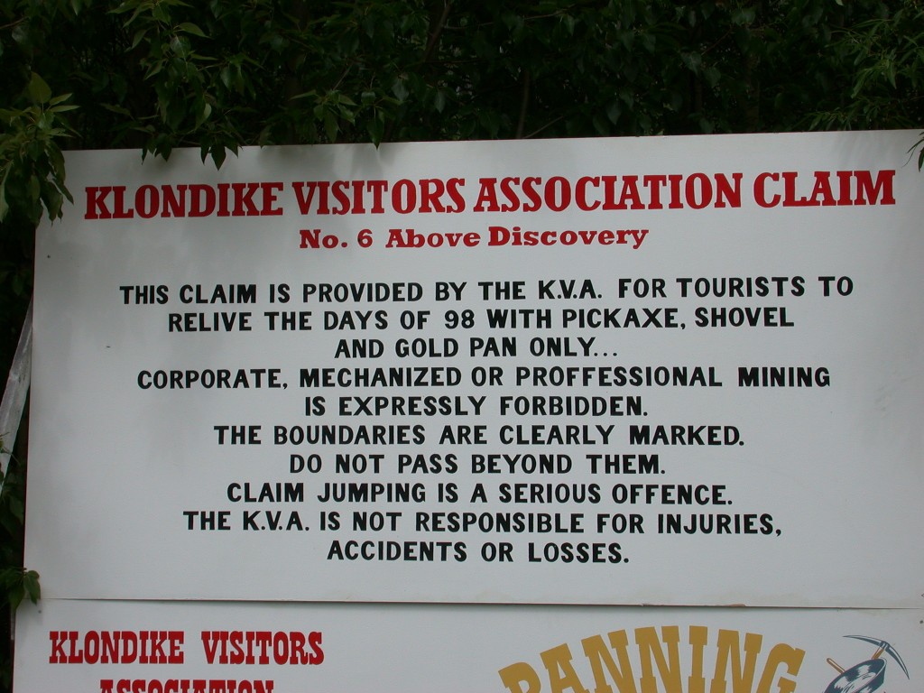
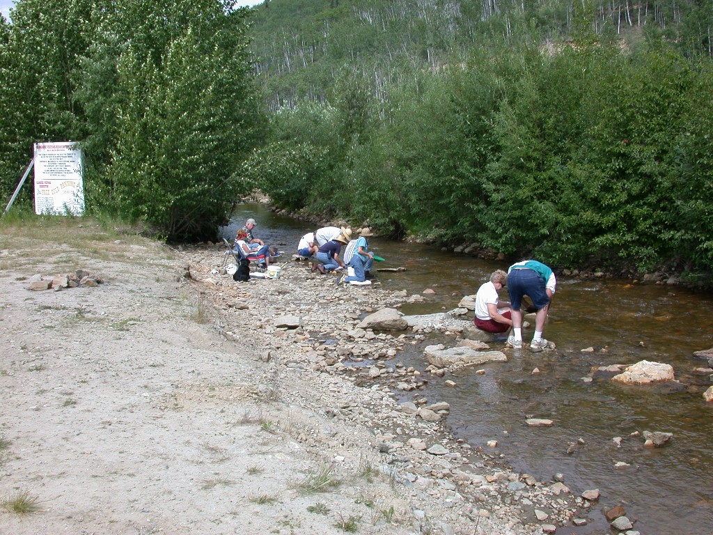
After the tour of the dredge, we continued out the road to the site of the Discovery Claim. We parked and walked down to the very small, seemingly non-descript creek that was the beginning of a great period in history. We returned to the truck and drove further out the creek to the site of Claim # 6, operated by the city, where you can pan for gold. There were a number of folks trying their luck, but no one had a find while we were there. There are still a number of individuals prospecting the areas around Dawson City and you have to be really careful and not get on the claims. They still take claim jumping seriously here!
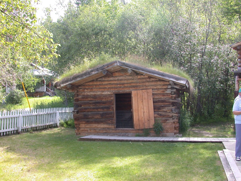
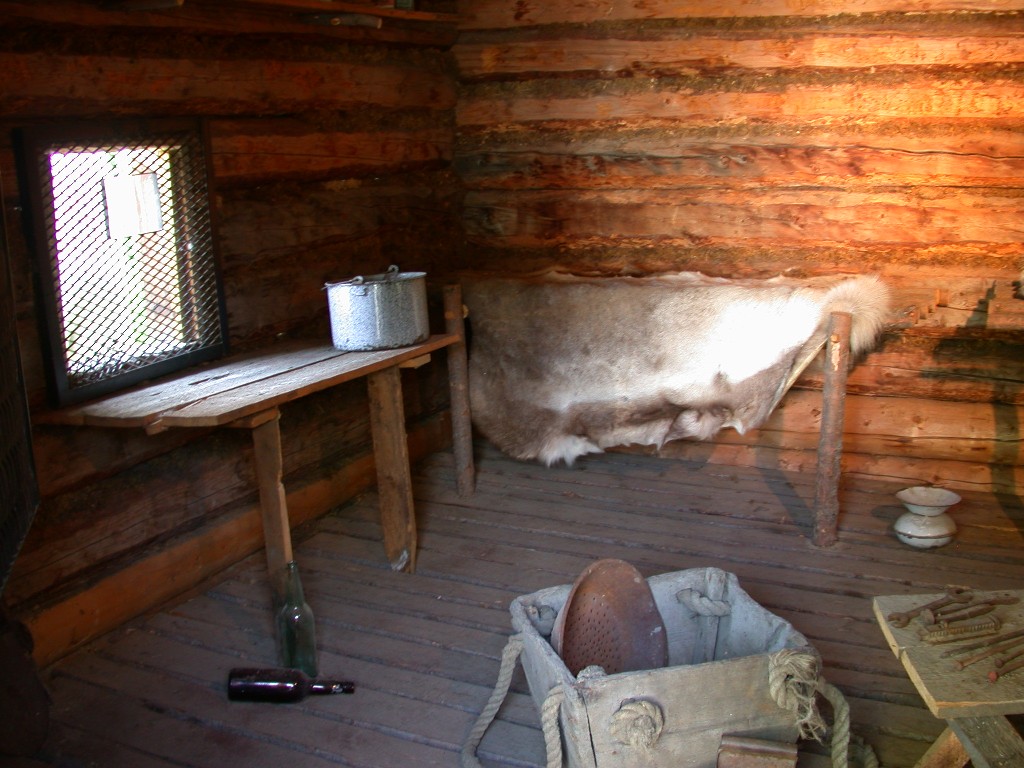
We then drove up to 8th
Avenue and visited the cabin
of Jack
Mr. North gave a very interesting program on
Jack
After the program at the cabin, we drove further up 8th Avenue to the cabin that was occupied by Robert Service and where he did much of his writing and where he lived when his first book was published. The cabin was closed for touring, as they were presenting a program and we had not purchased tickets for due to time restraints. We were able to get a couple of photos of the cabin.
When we visited the museum in Whitehorse, we had seen a video “The Robert Service Story” which had been done by a gentleman named Tom Byrne. We really enjoyed it and wanted to get a copy. We were unable to find it in Whitehorse and were hoping to find a copy in Dawson City. Imagine our surprise when we found that not only could we get a copy of the video, but also attend the program put on by Mr. Byrne. We purchased our tickets and spent a delightful 1-1/2 hours enjoying his presentation of “The Robert Service Story”.
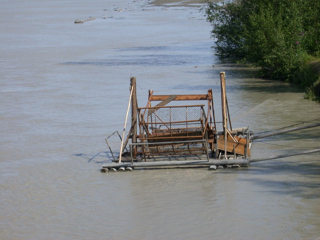
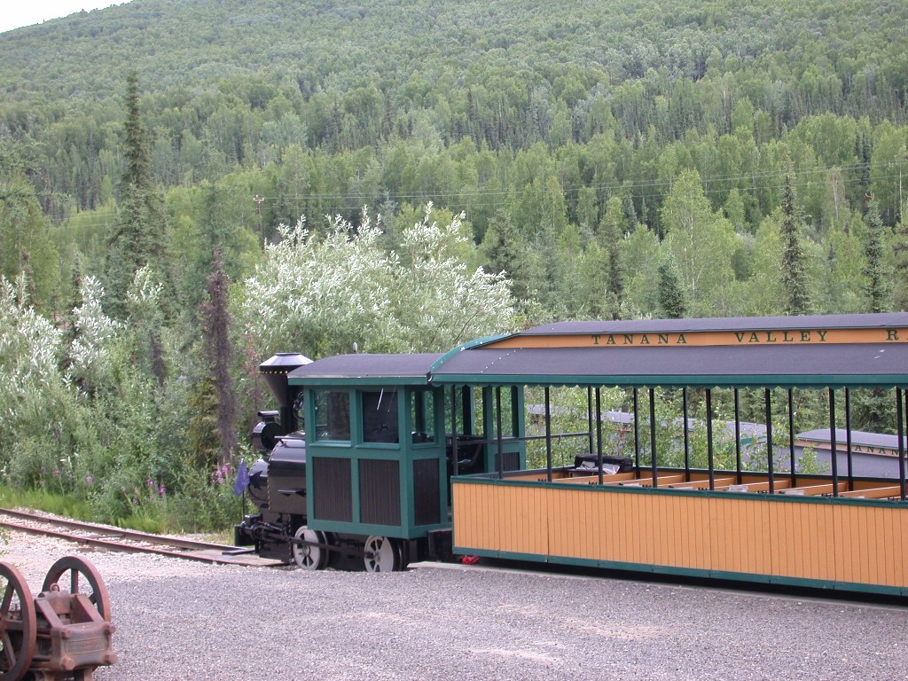
After the program, we headed to Front Street and a walking tour of the Dawson City waterfront with a costumed guide from Parks Canada. It was an informative and interesting hour. We toured the riverboat Keno, smallest of the sternwheelers plying the Yukon between Dawson City and Keno, carrying supplies to the town of Keno and silver ore back to Dawson City.
After a very good dinner at the restaurant at the campground, we rested for a while and then returned to town for the show at the Palace Grand. The original theater was built in Dawson’s heyday, using lumber from riverboats. It was used for many years and then abandoned. When the town began to be restored, the theater was deemed unusable, but was carefully measured, mapped, etc. A reconstructed theater is now in it’s place, constructed true to the old one, including paint and wallpaper, etc.
We enjoyed the production of the follies, depicting a lighthearted musical version of the early days of Dawson City.
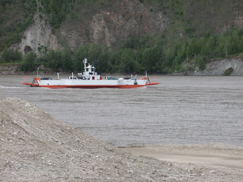
July 3 – One of the places we wanted to visit was Eagle, AK. It is only accessible via the Taylor Highway, reached from Dawson City by the “Top of the World Highway”. Top of the World can be reached only by crossing the Yukon River on a small ferry. Dick had looked at our maps and decided that our best bet would be to take a day trip from Dawson City (140 miles one way), as there are no commercial campgrounds in the area of the Top of the World and the road to Eagle is not recommended for large RV’s.
We headed for the ferry early. As noted before, it is a small ferry, and on Wednesday, the line of RV’s to board had been several blocks long all day. Dick didn’t want to spend a lot of time in line so we were at the landing by 7:00 AM and were able to drive right on and get across the river.
After driving off the ferry, we started the steep ascent to the “Top of the World”. Oh, did I forget to mention, it was raining!
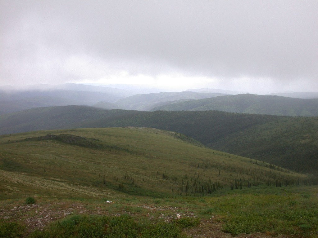
“Top of the World” is a 2-lane gravel road that
climbs and then runs along the ridges of the mountains above the tim
We crossed the border at Poker Creek, high on the mountain ridge. This is the northernmost border crossing between the US and Canada and is only open May 15 to Sept 15, open only 9:00 AM to 9:00 PM daily. The border was just opening when we arrived and there were quite few vehicles in line before us, including a couple of the antique autos we had seen in the Canada Day parade. The somewhat good gravel road on the Canadian side becomes rougher on the US side and much muddier when it rains. About 10 miles from the border, Top of the World ends at the junction with Taylor Highway and we turned right to go to Eagle. The Taylor Highway goes north 65 miles to Eagle, which is located on the Yukon River. At the junction, heading north, the “highway” into Eagle becomes quite narrow and winding, in many places only one lane wide along the mountainsides. It was quite an exciting drive!
We finally arrived in Eagle, a very tiny village on the banks of the Yukon and stopped at the only café in town for lunch. Our lunch was excellent, very surprising for such a remote area. While we were eating, we were quite surprised to see a tour bus pull in. Also, the antique cars we had seen at the border also arrived.
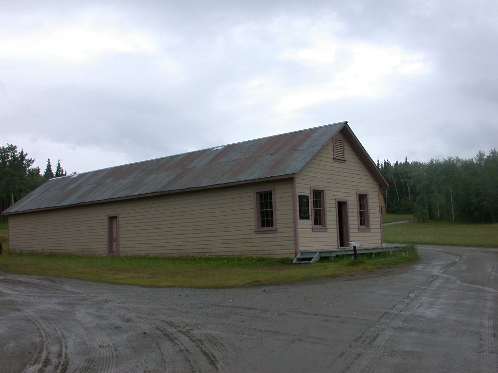
After enjoying lunch, we went to the Eagle Museum, housed in the old Wikersham Court House. We enjoyed the tiny museum. We then toured the site of Fort Egbert, a National Historic Landmark. There were originally 45 buildings at this fort. 5 buildings have been restored by the BLM. We walked around the buildings and looked at the displays in the Quartermaster Storehouse. On the grounds was a large area covered with wild strawberries. Some were ripe and Millie picked a few. They were smaller than half an M & M and were about the sweetest berries she had ever had. She would have loved to pick a bunch, but it would take all day just to get enough for some shortcake.
We then headed back out the “highway”, to Dawson City. On the way back, the weather cleared a little and we were able to stop and get a few photos. We arrived at the ferry and had to wait while the ferry took one load across and returned. On the return trip, a large tanker truck was carried. We boarded and soon were on the opposite bank and back in Dawson City.
In the winter, the river freezes and the few folks who live on the west side of the river drive their cars across. Our guide of the river front the day before lives on the west side and she said she has 6 weeks or so each in the spring and fall when she is unable to get across the river. As there are no stores, etc on the west side, she has to plan accordingly and make sure she has groceries, etc for that time.
After driving through town, we drove up to the top of Midnight Dome, a good place to view the town and where many go on June 21st to see the longest day of the year occur. As it was still raining, when we got to the top, it was foggy and we were unable to enjoy the view. Oh, well, nothing ventured, nothing gained.
July 4 – HAPPY BIRTHDAY AMERICA!
We got up early and were at the ferry landing shortly after 7. This time we were pulling the RV. The ferry was on the west bank, but the wait was short and we were first in line. After loading us on, they loaded several more vehicles and we were off. The Yukon River is very swift and the ferry is very small, but powerful. At first it seems that it will be pushed downstream, but as it nears the opposite bank, the current is slower and the ferry then maneuvers back upstream to the landing. Missy and Ming didn’t care for this part of the trip and they both crawled under the backseat to hide.
The truck pulled up the steep ascent to the
“Top of the World” and we were again top of the ridges above the tim
About a mile from the border, we pulled into Boundary. We had met a man named Jimmy Simpson this morning in our campground in Dawson City. He was in the space next to us. Jimmy is a writer and musician. He asked us if we would mind dropping off a box of his CD’s to Tony in Boundary. Jimmy’s wife wasn’t well and he didn’t want to have to make the 60 plus mile trip up and leave her all day. We found Tony with no problem and delivered the CD’s. Tony gave Millie a cup of his great coffee and we were on our way. (Still raining).
A little about Boundary. It is just a small group of buildings, less than half a dozen. There is also a small dirt airstrip there. It is on top of the ridge and the road is closed in the winter. Tony, his wife and 4 children live there year round. No phone, no running water and electric supplied by generator. They are the entire population of Boundary. They operate a small museum, café and gas station during the summer. In the winter they are up there alone.
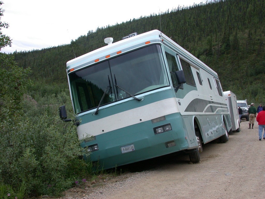
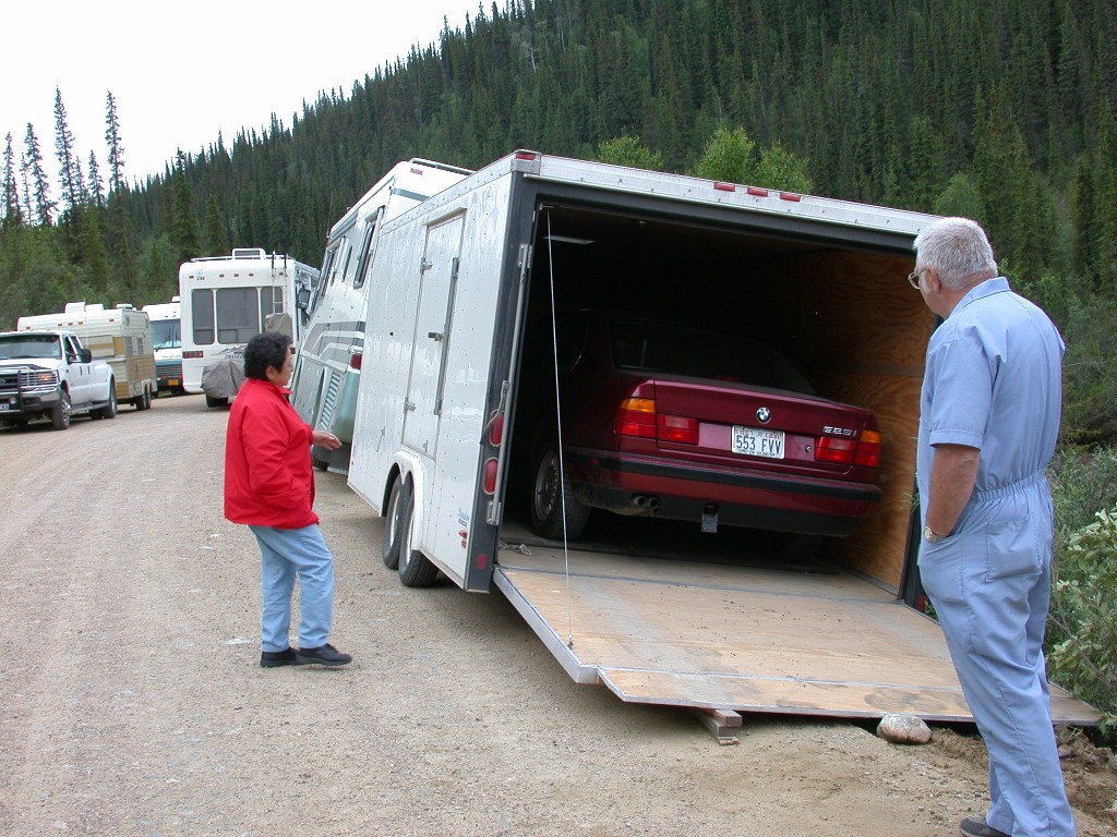
After leaving Boundary, we continued to the junction with the Taylor Highway, where we turned south. Driving down from the ridgeline, we came down in a valley area and ahead we could see a motor home that had left our campground that morning about an hour before we did. We had seen them several times along the highway. As we rounded the curve, we could see that the motor home was in trouble. He had gotten onto the very soft edge of the roadway and it had given way under his wheels. There were a couple of trucks stopped and we stopped to see if we could help. The couple was still in the rig, the door side being over the bank. As Dick carries a collapsible 7’ ladder, we were able to assist the couple in exiting the rig through a window on the driver’s side. They decided to try to extract their car from the trailer they were towing it in and see if the trailer could be moved. The owner tried to pull the car out, but it slid to the downhill side in the trailer and was making it more precarious.
By this time, a number of vehicles were lined up on the roadway. Two couples that mined in the area came by and one had a large stake bed truck with a winch. We knew he couldn’t winch out the motor home, but he did manage to winch the car out of the trailer. As we were blocking the road, after seeing that everything was as OK as it could be at that point (someone headed to the border to have them send for a heavy duty tow truck), we got back in our rig and continued on.
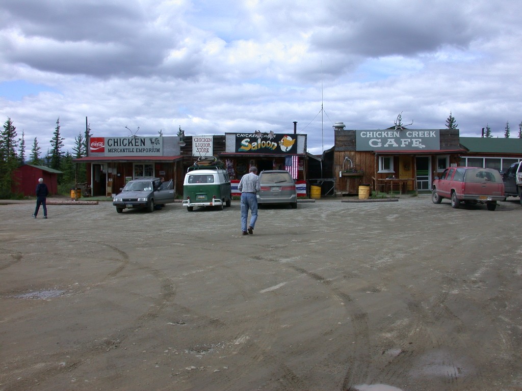
We arrived in Chicken, AK around 1:00. We stopped at “Beautiful Downtown Chicken” and had lunch at the café. The food was good and large portions, but expensive. Chicken has a population of about 15 in the winter and 50 or so in the summer. It is really quite a tourist attraction. The post office there gets mail twice a week. It is the center of activity for the surrounding area. The miners who had stopped to help with the accident had told us that everyone around was heading into Chicken for the 4th of July Picnic. As we left “town” and passed the Post Office, we could see a large crowd gathered up on the hill.
Just a short explanation of how Chicken got its name. The early settlers there wanted to name their town Ptarmigan after a bird about the size of a small chicken that is native to the northwest. However, no one knew how to spell the name, so they settled for Chicken, which is a common name many use for the bird.
Shortly after leaving Chicken, we discovered we had no 3rd gear. Now on the road we were on, that was no big deal, you couldn’t drive fast anyway. We continued south and about 30 miles further the road was improved. It was now gravel chip and seal and seemed like a super highway compared to the rest of the road. Third gear decided to work.
Another 50 miles and we reached the junction with the Alaska Highway and continued into Tok, AK (rhymes with coke). We checked into Sourdough RV Park and promptly headed over to the RV wash to clean up the rig. An hour later we pulled into our site and got set up.
We had our mail sent to Tok, so we drove up to check on the Post Office and see what the hours were. No third gear. After going to the post office, we hunted for a place to eat dinner. We found a restaurant named Fast Eddie’s that had a full parking lot and figured that must be the place to eat. We had an excellent meal. Millie was thrilled to find baked potatoes on the menu, apparently no one in Canada eats them and we hadn’t seen them on a menu in about 3 weeks. After enjoying our dinner, we headed back to the RV Park. Third gear working.
We now have cell phone service, so we made
calls, touching base with family. Dick called Ford to check on what we needed
to do regarding the truck. We are still under warranty. They gave him the
number of the dealer in
July 5 – We were up early and Dick headed out to the post office in order to be there when they opened. He soon returned without mail. The desk is not open on Saturday and he could not talk the man into giving him our mail. We will have to stay until Monday. We spent most of the rest of the day relaxing. Late in the day we drove into Tok, visited their visitor’s center, where we saw a great video on the building of the Alaska Highway and then headed to Fast Eddie’s for dinner. After another delicious dinner, we came back to the park, watched TV and off to bed.
July 6 – Another quiet day. We drove into Tok in the afternoon to check out a place that advertised a sled dog demo, but found out they only had some puppies on display and no sled dogs to be seen. Back to the park, dinner and quiet evening.
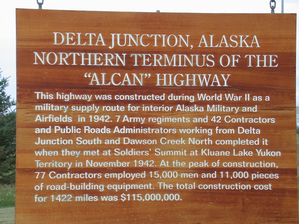
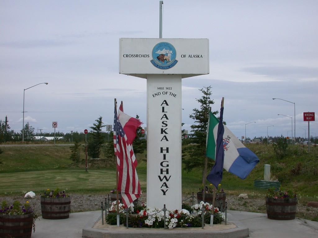
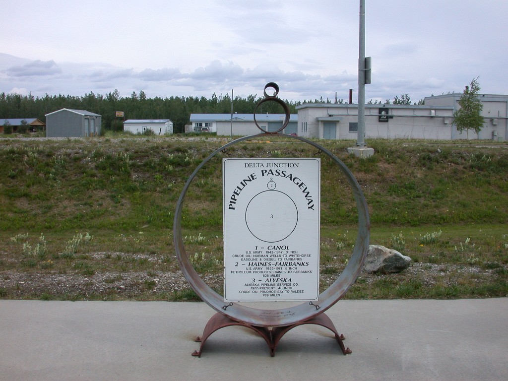
July 7 – Dick was up early and off to the post office. He returned shortly with our big box of mail. We packed up and hitched up. North on the Alaska Highway to Delta Junction, the official end of the Alaska Highway. We stopped at the visitor’s center and saw the actual mile marker that indicates the end of the highway. They also had a display about the Alaska Pipeline. One of the items displayed is a "Pig", a device used to clean out the pipeline. You get your first look at the pipeline outside Delta, where it crosses the river. Delta Junction is a farming area; they grow a lot of barley here. They also have a large herd of free ranging bison; they were transplanted here in the 1920’s and have prospered. We saw a few of them back from the road a distance.
We also saw Moose today. The first was a cow with 2 calves. They ran across the highway in front of us. Then we saw another cow grazing along the opposite side of the road. Still haven’t seen any bulls.
In Delta, we picked up the Richardson Highway
into
We had made reservations at Riverview RV Park
in North Pole, AK, about 10 miles outside of
July 8 – After doing some house cleaning, etc we went to the park office to arrange for tickets to various attractions we wanted to see. Afterwards, a trip to downtown to the post office, we needed to send out paperwork for Dick’s retirement pay and also our truck license renewal. We checked on the truck, nothing done so far.
We drove back to North Pole and Millie visited “The Quilting Trail”, a lovely quilt shop. She enjoyed talking to the salesperson there and browsing the fabrics and patterns. Dick stayed in the car and snoozed.
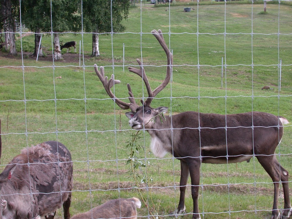
Of course, North Pole brings to mind Christmas, so we visited the large store at North Pole. Santa is in residence there all year long and they even have a herd of live reindeer. They say North Pole has more Santas, elves and candy canes per capita then anywhere else in the world. The mayor’s office is even decorated for Christmas year-round.
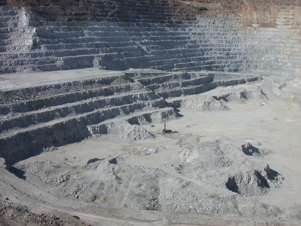
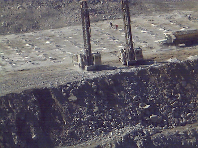
July 9 – Our day began with a drive to the
Fort Knox
Gold Mine, about an hour north of
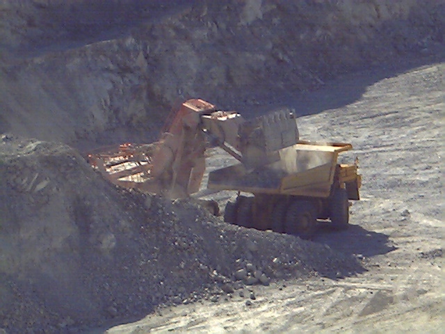
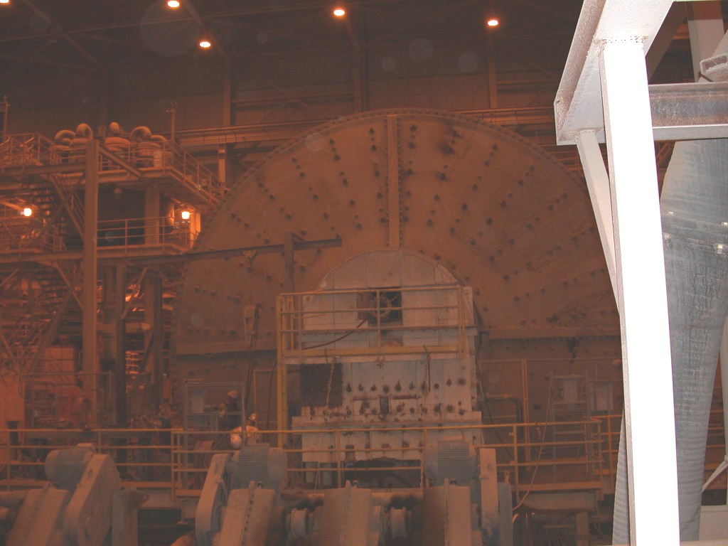
The crusher is a giant rotating steel column inside a steel outer drum. The rock from the blast is dumped into the top, goes down six stories through the crusher, and then is taken by conveyer belt to the stockpile. They like to say that they take boulders the size of VW’s and turn them into 5” rocks.
The rocks from the stockpile then go to the mill via another conveyer belt. There it is put into a rotating drum containing 5” steel balls, which crushes the rock further. This is screened and then placed in one of two rotating drums containing 3” steel balls, which reduces the rock to a fine powder almost like flour.
The gold bearing powder then goes to the area where it is mixed with cyanide in giant tanks, which helps remove the gold. The resulting gold is then melted in a giant furnace and very high temps and poured into ingots, which are 92% pure. These ingots are then sold.
This mine operates 24 hours a day, seven days a week, 365 days a year. It takes 24 hours to get enough gold for an 88 pound ingot. As it is costly to heat the furnace, gold is only poured once a week.
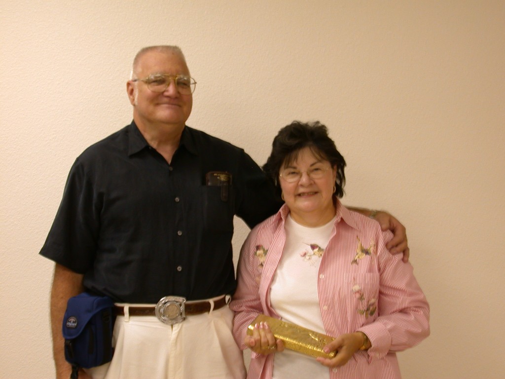
Due to a shut down for maintenance, we were unable to see the crusher and mill in actual operation, but were still able to see the equipment. After our tour, we were taken back to the administration building. There, we were allowed to hold a small ingot, about ¼ the thickness of a full one and have photos taken. The ingot we are holding was valued at $88, 000 + on the market as of today. The value fluctuates daily, as the price of gold is allowed to float.
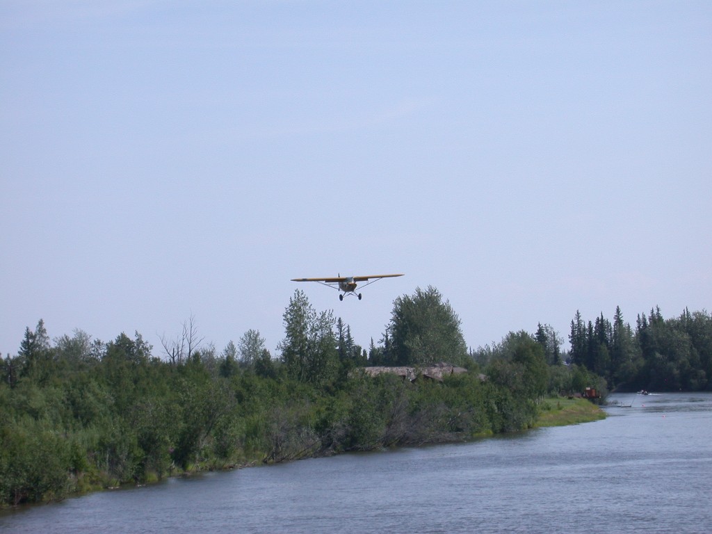
We came back to the park and had lunch, and then we were off for an afternoon on the riverboat Discovery, III. This enterprise is owned and operated by the Binkley family and they are in the 4th generation of riverboat pilots now. The boat left the dock on the Chena River and turned around, heading down river. Our first stop was a small airfield along the river where a demonstration was given on bush pilot flying. Did you know that Alaska has more licensed pilots than licensed drivers?
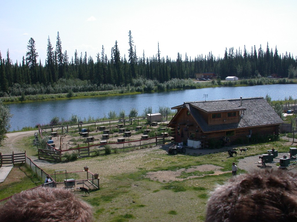
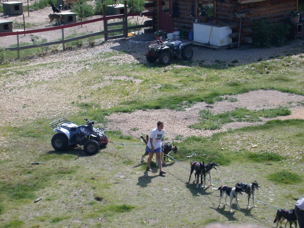
Our next stop Trailbreaker Kennel, where Iditarod Champion Susan Butcher and her husband Dave Monson (also a champion dog musher) raise their dogs. As the boat sat offshore, Susan and Dave gave us a history of their dogs and told us a little about raising sled dogs. A team was then harnessed up and we were given a demonstration of how the dogs work.
After bidding goodbye to the dogs, we proceeded on down the river, to the mouth of the Chena, where it flows into the Tanana. Near the mouth, several boats were salmon fishing and held up their catches for us to see as we passed by. The Chena River is a clear stream and the Tanana is a murky, silty stream due to glacier melt. Salmon fishing is not good on the Tanana as the fish cannot see the lure, but when they go up the Chena they can be caught. At the conflux of the rivers, a very interesting thing occurs, the silt-laden water from the Tanana flows into the clear water of the Chena and columns of silt billow up in the clear water.
We turned up the Tanana, a swifter flowing river, and enjoyed various geological sites along the way. We passed the town site of Chena, now a state park. The town is gone, but in the early days was a busy river port, with many vessels stopping.
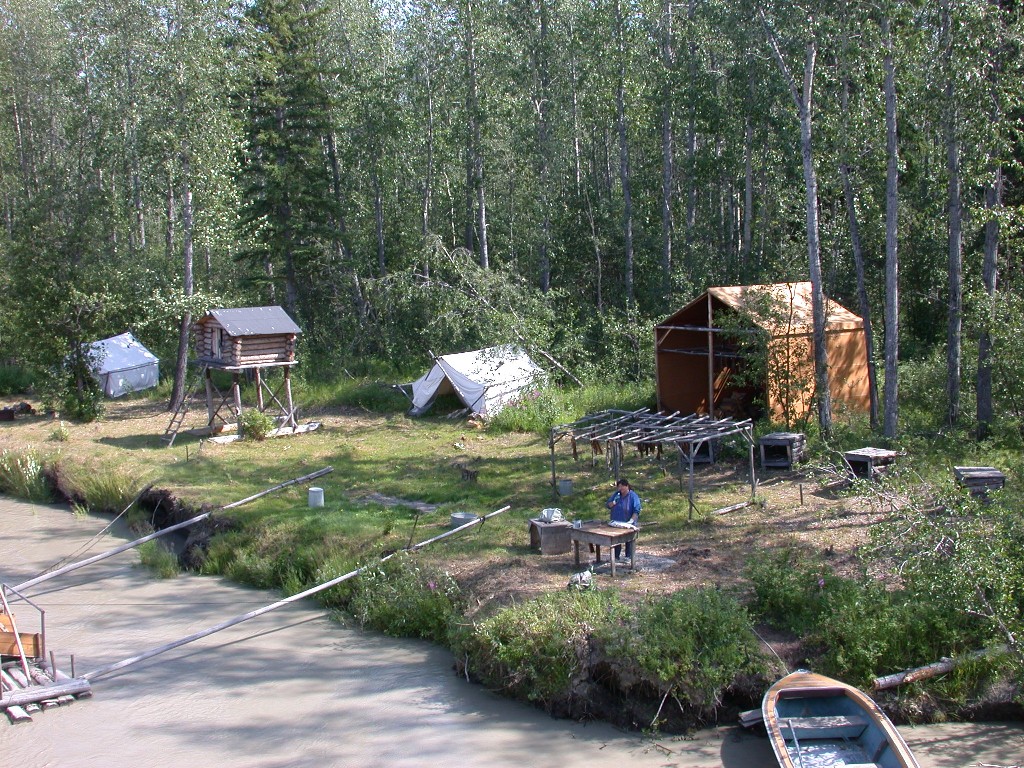
Further down the river, we were introduced to Dixie Alexander, an Athabascan Indian. Dixie gave us an informative program on a native fish camp and demonstrated her skill at filleting a Chum Salmon. She was able to clean and filet the fish in less than a minute! The Chum Salmon are also known as “Dog Salmon”, as they are dried and fed to the sled dogs. They are an excellent source of protein for the dogs. We also were able to see a working fish wheel, used by the Indians for catching fish.
After our Captain turned the boat, letting the swift current do most of the work, we docked at a recreated Interior Alaska Indian Village at the time of the white traders. Our guides were very knowledgeable young Indian ladies. Dixie Alexander, who we met earlier, is also an expert in skin sewing and beadwork. She lives at the village in the summer and demonstrated her work. She has work on display at the Smithsonian in Washington. Her fur parka was breathtaking. The Indians like to use these parkas for special occasions and it can cost thousands of dollars if you can find one to purchase. Also at the village, Dave Monson gave us another presentation on the sled dogs. He had about 10 or so of the dogs there and told us about the dogs and how they are cared for. He had one of the dogs model the coat they wear in very cold weather. He also showed us the boots that are put on the dogs in certain types of snow to protect their feet. One of the dogs also modeled one of the boots. The dogs are very friendly and were happy to be petted.
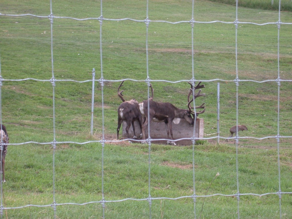
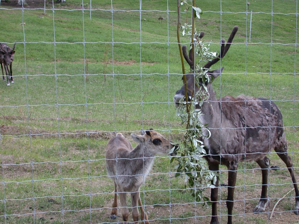
We were also introduced to a group of Reindeer. Reindeer are the same as Caribou, only they are domesticated. They were brought here from Russia to help the natives when the natural herds of Caribou were on the decline. We were able to touch them and feel the velvet on their horns. Both male and females have horns. There was a calf around 4 months old and it was already sprouting its horns.
After spending about an hour at the village, we
re-boarded the boat for our return to
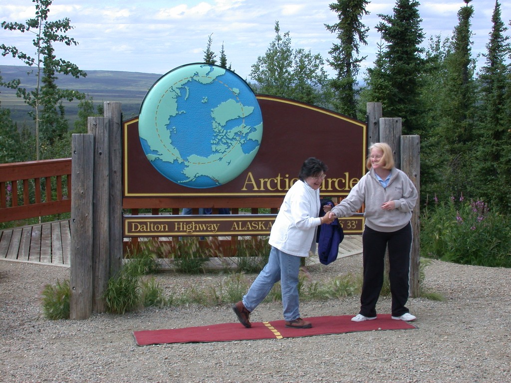
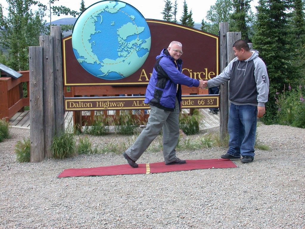
July 10 – At 6:15 AM we are standing in the office of Northern Alaska Tour Company in the company of 23 other sleepy travelers. We were given a brief overview of our day before boarding our bus with our guide and driver, Tom. We are heading for the Arctic Circle.
We left
We followed the Steese Highway to the Elliot Highway. Tom gave us a running commentary on the area and gold mining. We stopped to see the small individual mining operation at Sniper Hill.
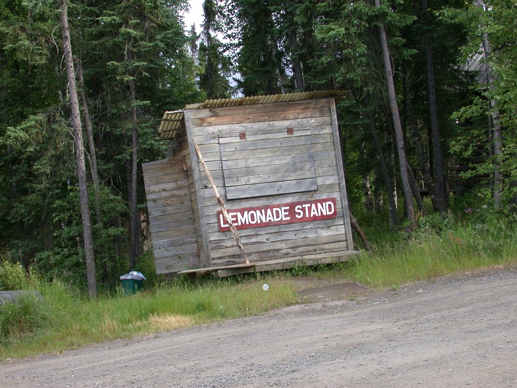
Our first off the bus stop was Joy, AK. Joy is not really a town, just a homestead. In the 1960’s Alaska encouraged homesteading and a couple from Minnesota came to this area. In the 70’s, a couple named Carlson were able to buy some acreage from them and settled there with their 7 children. They had determined early in their marriage that they wanted a large family. They arrived in a converted school bus and built a cabin. In the next 30 years they have raised 33 children, 23 of which were born to them or adopted and the remainder were foster children. Joe Carlson worked on the pipeline when it was being built. As the construction workers and supplies passed by their home, some of the children decided they wanted to open a lemonade stand. That first summer they did pretty good and the next summer they made more money than their father did! The family then decided to open a store, which they still operate today. Debbie, a neighbor who helps out, gave us a brief tour of the property. The Carlson cabin is very large, with 9 bedrooms. A generator provides their power. They are presently in the process of adding on to the house, although they only have a few children left at home. Their children range in age from 40 to 10. The children are home-schooled.
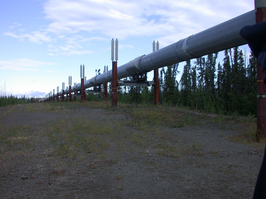
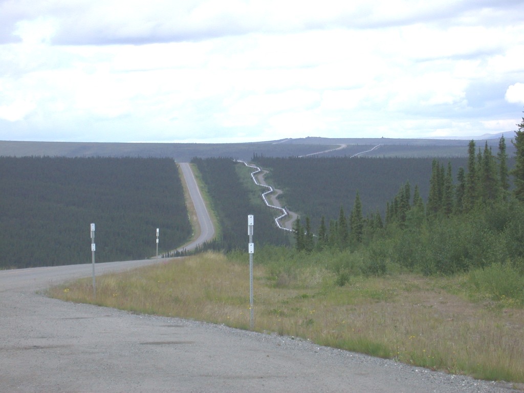
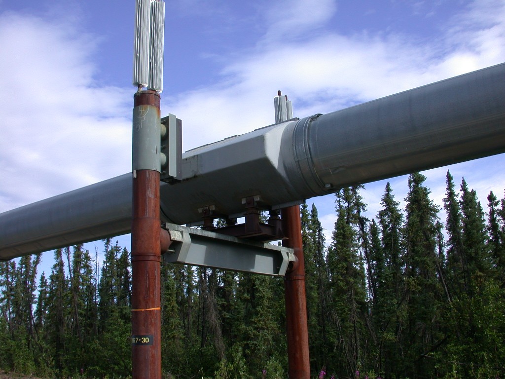
We re-boarded the bus and continue up the Elliot Highway to Livengood (pronounced like alive). There we left the paved road and onto the Dalton Highway, also known as the haul road. This road is presently being upgraded to a paved road. Completion expected in 2010. Originally the road was a private road built to service the pipeline and it’s construction. It was given to the state of Alaska in the 1980’s and the public is now allowed to drive on it. It is gravel and very bumpy. We were happy to have Tom doing the driving. Along the way we saw sections of the pipeline and two of the pump stations that keep the oil flowing.
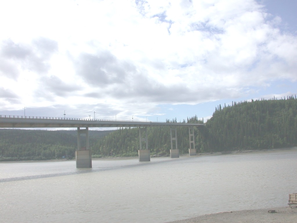
Our next stop was at Yukon River crossing. We
crossed the bridge over the river on the bridge that also carries the pipeline.
It is a fairly long bridge and you cannot stop on it Security is very tight
along the pipeline and the bridge has cameras both on the bridge and under.
There are also speakers along bridge and they will warn you if you do stop. At
the crossing there is a restaurant, motel and gas. We left the bus and had a
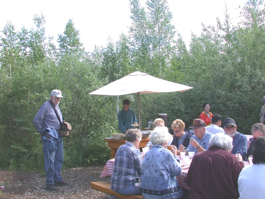
great picnic lunch by the river, furnished by the tour company. Everyone
enjoyed themselves. There were a number of boats tied up at the crossing and
Tom told us that there is an Indian village further upstream, accessible only by
river. The folks from up their keep their cars parked at the crossing and come
down in their boats to go into
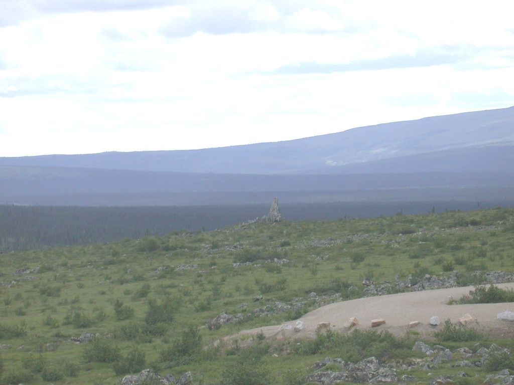
After lunch we continued north. Our next stop
was Finger Mountain. One of the
granite formations on the mountain resembles a
finger pointing and has been used for a navigational aid for many hundreds of
years. The bush pilots say it points to
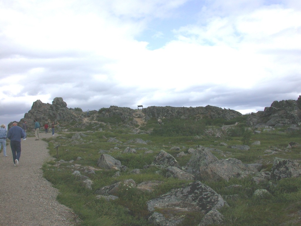
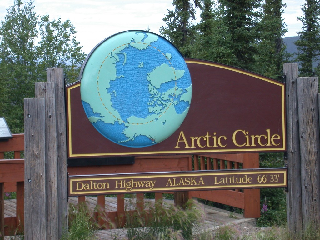
Finally we reached the Arctic Circle. There is an interpretative display there and a small campground, both maintained by the BLM. Tom parked the bus and we all hopped off. Tom rolled out a red carpet, making sure it was in the correct spot and then gave us instructions on the “proper way” to cross the circle. We all had great fun crossing the circle and congratulating one another. Tom, as a celebration of our crossing then served us chocolate cake.
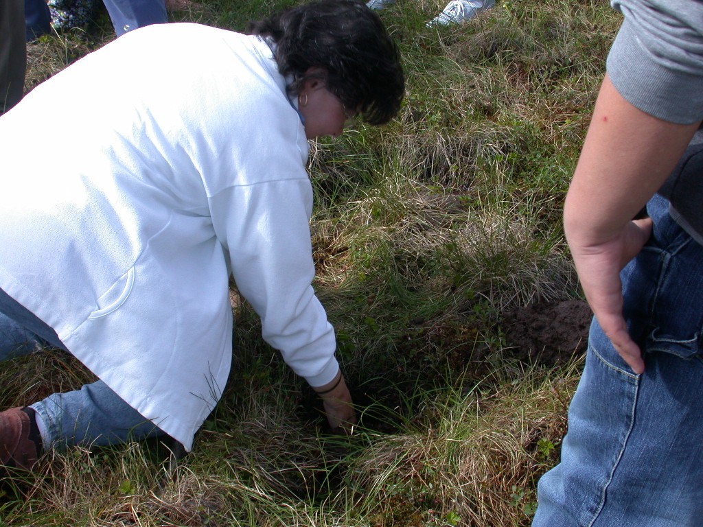
On our return trip we made a stop at a pipeline area where the tundra was accessible. We again learned a few facts about the pipeline and were able to touch it. Tom also gave us the opportunity to actually touch permafrost. He dug a hole less than 12 inches deep, reaching the solid ice below. We were all invited to feel the ice. It is strange to realize that the ice is that close to the surface of the ground. The tundra is also very spongy to walk on and if you stand in on spot, the water will come up around your shoes.
Here are a few things we learned about the engineering marvel call “the pipeline”. It begins at Prudhoe Bay on the North Slope and travels to Valdez, the northern most ice free port in the U.S. It is 800 miles long. The pipe is 48” across and has an outer layer of insulation and steel. The “throughput” had been as much as 2.1 million barrels a day and is presently about 1 million barrels per day. It takes 6 days to make the 800-mile trip.
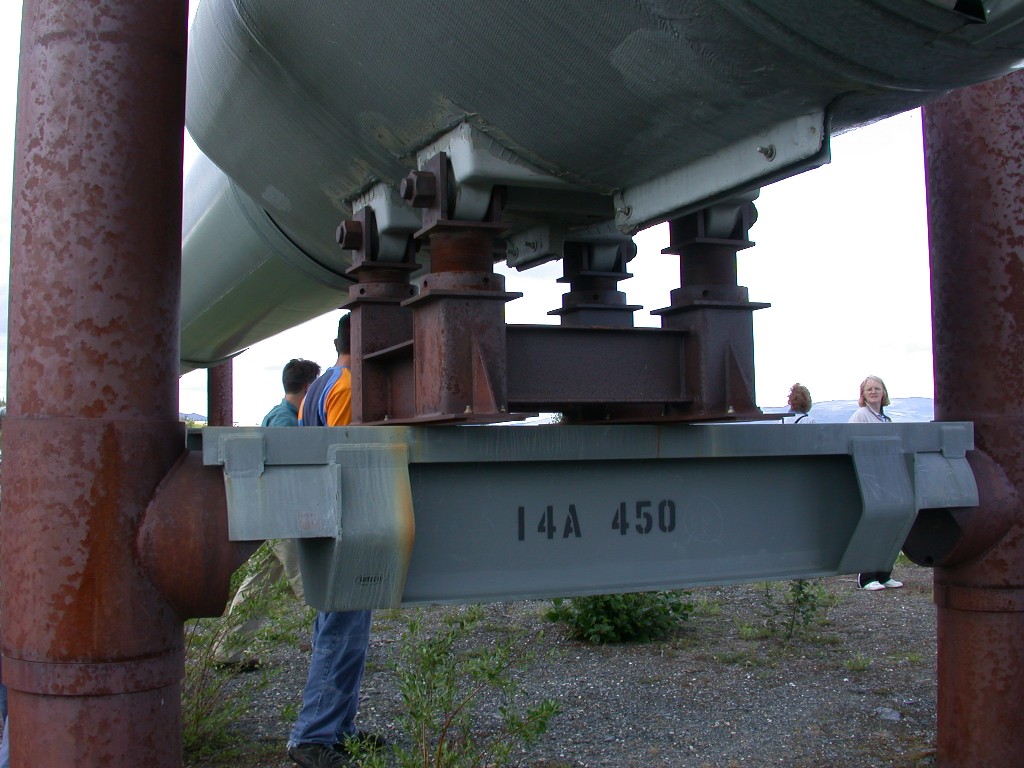
Less than ½ of the pipeline is underground. The reason for this is that the temperature of the oil is over 116 degrees when it leaves the ground. If the pipeline was placed under the tundra, it would melt the permafrost. The rest of the pipeline rests on 78,000 supports above the ground, set in pairs 60’ apart. The pipe is set in a zigzag pattern, this accomplishes two things. One- as the oil flows downhill, the pattern helps slow the oil down. Second – the areas can experience as much as 160 degrees in temperature swings. –70 in the winter to 90+ in the summer. The pipe expands and contracts. The bends allow for the expansion.
The pipe is not fastened to the supports; it is attached to glides with Teflon on the bottom, which slides on horizontal supports attached to the pair of upright supports. Every 10th support or so has a large rubber bumper attached which prevents the pipe from hitting the upright.
There are 11 pump stations along the way that keep the oil flowing at a constant rate. Presently only ½ of them are operating, as they are not all needed for the flow rate to be maintained.
We were not aware of how much technology had been developed while this great pipeline was built. It has withstood the harsh weather, a 7.9 earthquake, and forest fires with no spills. Security is very tight and many areas are not closed to the public without a permit.
Our dinner stop was again at the
Yukon River. Those who had not brought something with them to eat had filled
out a dinner menu on the trip up and when we arrived at the river, dinner was
ready. We enjoyed our dinner, and then reboarded the bus. Our next rest stop
was again at Joy, then we continued on to
We were tired when we got home but had really enjoyed our day. We were off to bed as soon as we got home.
July 11 – We slept late, as we were quite tired after our long day yesterday. After a leisurely breakfast, we headed into town to do errands. We stopped to check on the truck, it was still not ready. We then went to the local Sam’s Club to get a few things.
We drove to Pioneer Park, where
we enjoyed looking at the display of historic buildings and a sternwheeler on
display there. Most of the buildings had been collected from the city of
We then had an early dinner and went grocery shopping.
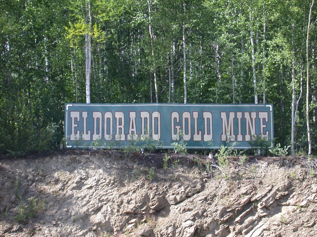
July 12 – After breakfast we headed out the Elliot Highway to the Eldorado Mine for a tour we had booked earlier in the week. We arrived at 9:30 for our 9:45 tour only to find the gate locked and a sign indicating that tours were only done at 3:00 on Saturdays. We drove back to the campground and went to the office, where we had purchased our tickets, to get the problem straightened out.
The girls in the office called the Eldorado and got us booked on a tour at 3:45 that had been added that day. Although the earlier tour time had been confirmed by the El Dorado, someone made an error. Oh, well, we had nothing else planned for the afternoon.
Dick went back to the trailer to hang out and Millie decided the “found” time would be a good opportunity for a visit to “The Snow Goose”, a quilt shop here. She found the shop and enjoyed looking at their huge collection of fabrics. She also stopped at the local “Jo-Ann’s Fabric Store”.
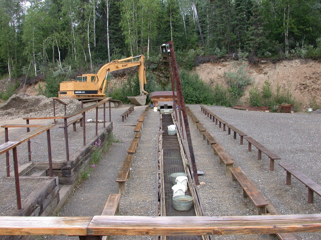
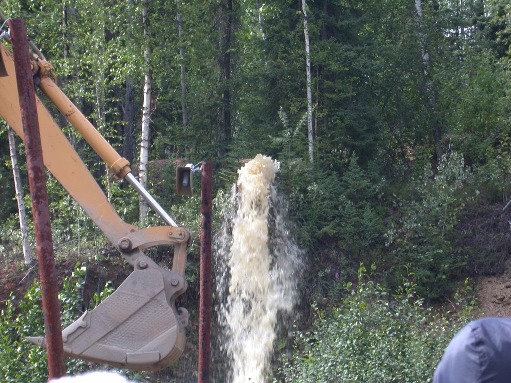
We drove to the Eldorado in the late afternoon. At the Eldorado we boarded a small replica of a narrow gauge train that had operated in the area. We were given a tour of an underground mine area and shown how the ore bearing rock was removed from the shafts during the early days of mining in this area. We then left the train and everyone was seated along a 100’ sluice box where we were given a demonstration of how the gravel was washed and then the gold was extracted from the gravel. The water for the sluice box came from a storage area on the hill and was quite a sight when it was released. We were also given a demonstration of gold panning.
Now it was our turn. We were taken to a large pavilion where we were each given a gold pan and a bag of gold bearing gravel. In the pavilion were long troughs of water where we panned our ore. It was fun and everyone was guaranteed to get gold. The gold is flake gold, very few nuggets, but we enjoyed the experience. After putting our gold in a container, we entered the “cook shack”, were our gold was weighed and we were treated to cookies and coffee, tea or cocoa. We put our gold together and Dick stood in line to have it weighed. Ours was given a value of about $15.00, not enough to retire on!
After everyone had their gold weighed we again climbed on the train and were returned to the parking area. This attraction is also run by the Binkley family who has the Discovery riverboat and their programs are great.
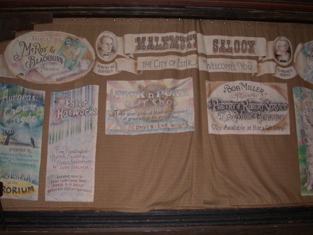
Our next stop was Ester, AK. Ester had been a gold mining town off and on from the 1900’s. We had dinner at the Ester Gold Camp Dining Hall. It was a buffet dinner with country style chicken, halibut, reindeer stew and their specialty, Alaska crab. It was a good dinner and we were full when we left the table.
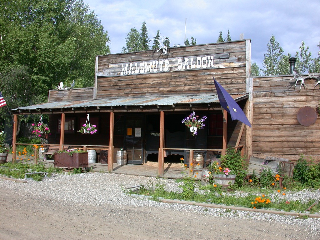
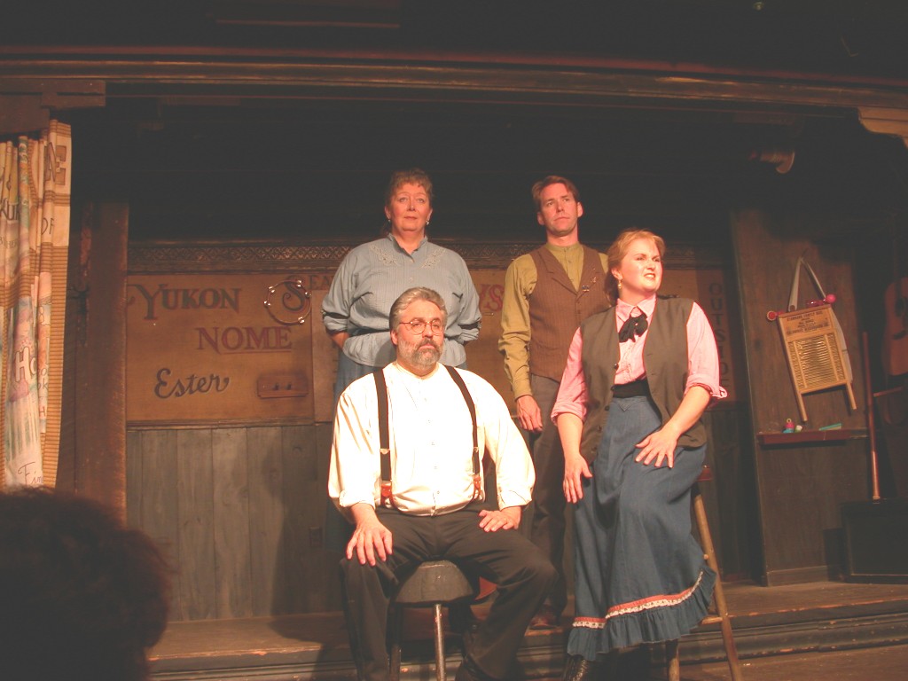
After dinner we headed to the “World Famous Malamute Saloon”. There a cast of 4 presented a great evening of entertainment. The saloon is kept in the old style, with sawdust on the floor and you can have peanuts and toss the shells on the floor. We enjoyed the comedy skits, music and poetry of Robert Service.
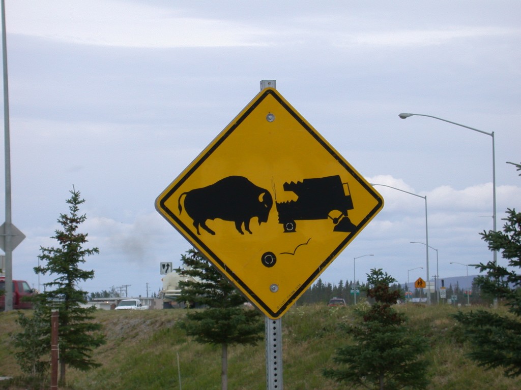
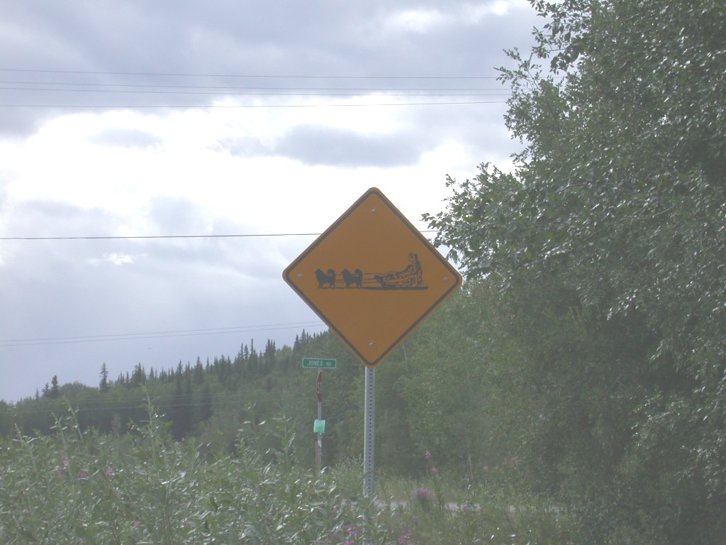
On our way to Ester we saw a road sign that we thought was very amusing. You don’t see too many of these!
July 13 – We woke up to rain. After breakfast we just relaxed for a while and watched some TV.
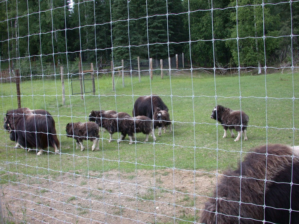
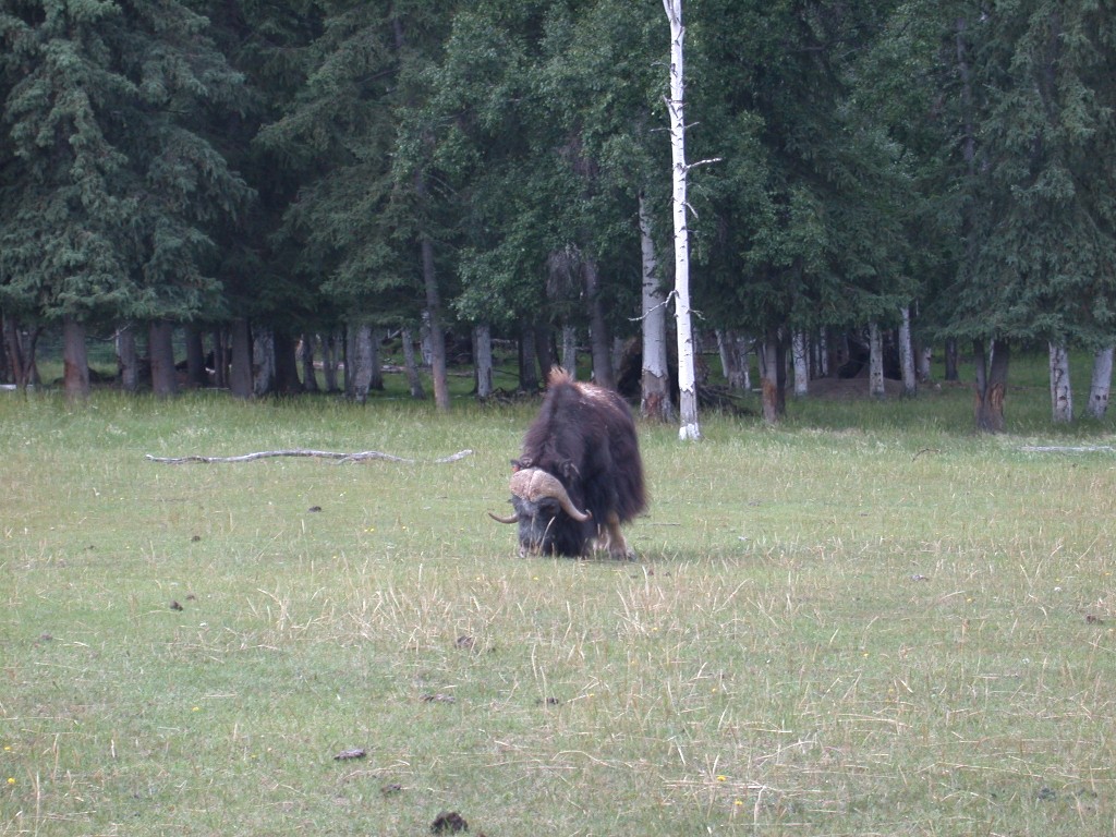
At 1:00 we drove to the University of Alaska Large Animal Research Station where we were given a tour. We saw musk ox bulls, cows and calves. The bulls are aggressive and cannot be approached by the staff unless they are on tractors. The calves were really cute. They also have herds of reindeer and caribou. The staff explained to us the difference between the two and we observed the herd as they ate willow branches and lichen. We also enjoyed seeing the little ones.
It was beginning to sprinkle as we got back in the car and drove to the museum at the university. We spent a couple of hours touring this facility.
One of the exhibits was about Alaska during WWII. We did not know that the Japanese had actually invaded the Aleutian Islands. 45 Aleuts were taken prisoner and put on a ship, where they were taken to Japan. Only 25 of the prisoners returned home after the war. 20 died in Japan.
The other thing that we learned was about the relocated citizens of Alaska during this war. Alaska had a large population of Japanese-Americans and they were taken south to live in camps during the war. The Aleut people were also relocated in camps in Alaska and most of their villages burned to prevent the Japanese from using them. They were told to evacuate with no advance warning and many had very little belongings with them. Of course, after the war they returned home to find they had nothing. It was very sad to know this had happened.
By the time we left the museum, it was raining steadily, so we returned home and fixed dinner then spent the evening reading and watching TV.
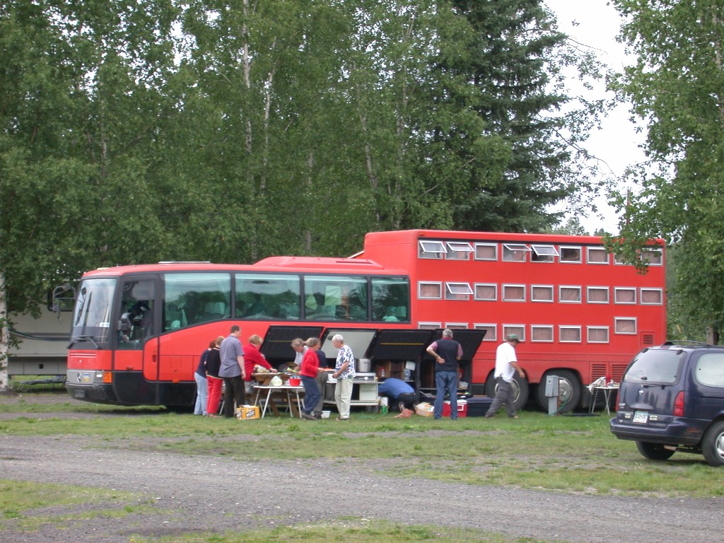
While at the museum, we had seen a large bus-RV combination in the parking area. A group of Europeans were in the museum and we believe they were on this bus. While we were having dinner, the bus pulled into the campground and set up just across from us. We had also seen one of these several years ago while on a trip to Yellowstone. We thought it would be interesting to let you see a photo of it.
July 14 – It is raining again. We don’t have any plans for the day, so we just hung out. Dick called to check on the truck and it still isn’t ready. Maybe tomorrow. The sun cam out for a bit later in the day, but it was cloudy again by dinnertime.
July 15 – Awoke to heavy rain this morning. We decided it was another day for just hanging out. Millie worked on her cross-stitch and Dick watched TV. At one point, Dick happened to look out the window just as a moose ran through the campground. Dick went to the Ford dealer to check on the truck and Millie worked on catching the journal up.
Dick returned around 5:00 with the truck. We will be heading to Denali National Park tomorrow morning. Hopefully the rain will stop.
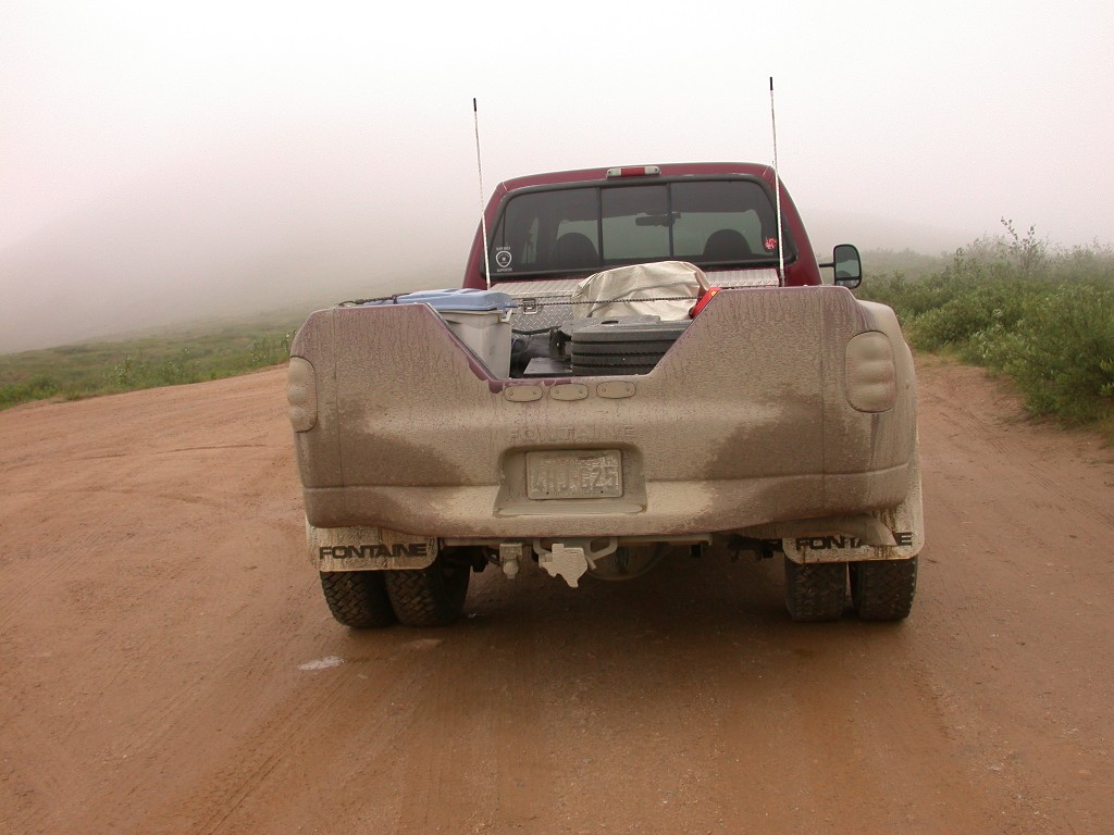
July 16 – Moving day. It is cloudy and cool this morning, but no rain. We left the RV park and headed south on the Parks Highway. Before an hour had passed it was raining. We had to stop several times for construction on the road and went through a lot of gravel areas. The truck and 5th wheel are really filthy now. Once we got past the gravel stretches, the rain did wash a lot of the mud off.
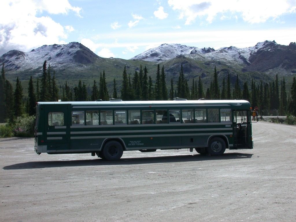
We arrived at the RV park outside Denali and got set up in our space. We decided to go to the National Park and find out when we could get bus reservations. Most of the literature we had said it could require a wait of 2 days for a reservation. We were surprised to find out that we could get our bus tour the next day. After purchasing our bus tickets, we drove back to the “strip” and found a place to have something to eat.
After eating we headed back to the trailer. We spent the evening relaxing, watching TV and reading. Around 7:00, Dick looked at the temperature and commented that it was getting cold enough to turn the rain to snow. Millie looked out the window and it was snowing!! Big, clumpy, wet snowflakes. It snowed all evening. July 16th and it is snowing!
July 17 – Happy Birthday Robert. The snow is over but it is still clinging to the trees, rocks, etc and is really pretty. Total accumulation was about 4 inches. It is overcast and we have our bus trip into the park today. We dress warmly and head to National Park Headquarters to board our bus.
We boarded our bus with our driver Dave and headed into the park. In very short time the sky began to clear and the sun came out. It was really beautiful to see the trees, etc with the sparkling new snow on them. Dave gave us a commentary as we drove along and pointed out various mountain peaks, landmarks, etc. Our first wildlife spotting was a family of Ptarmigan. There was a male, female and their chicks. We also saw several little Artic Ground Squirrels.
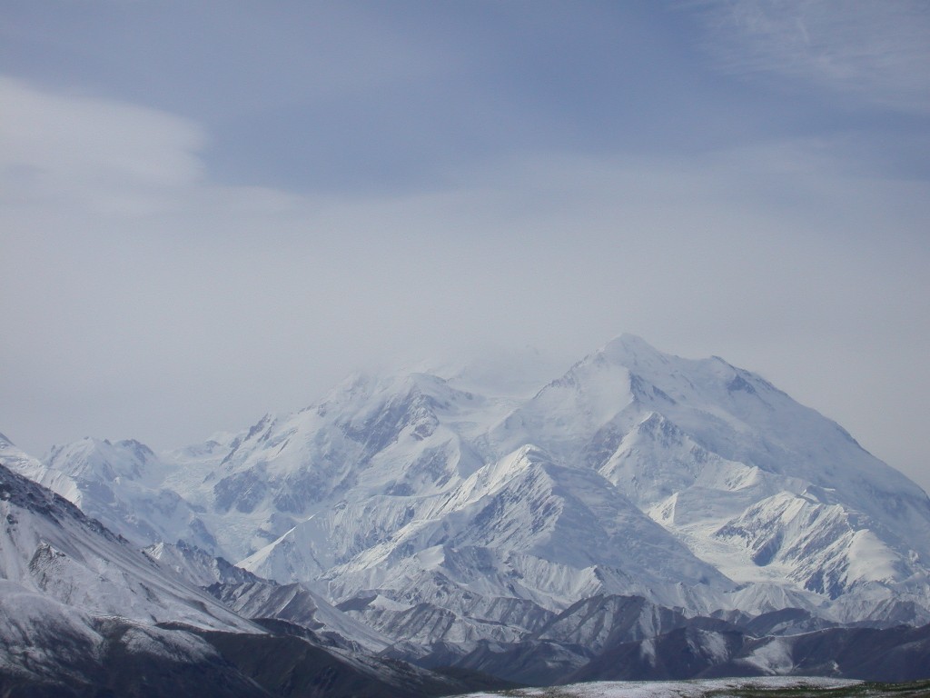
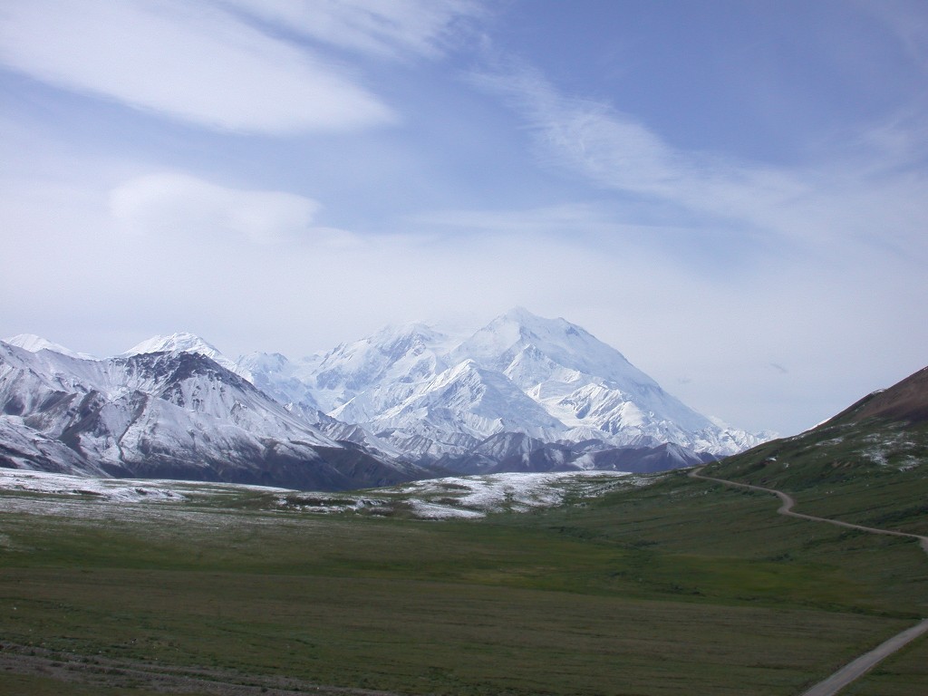
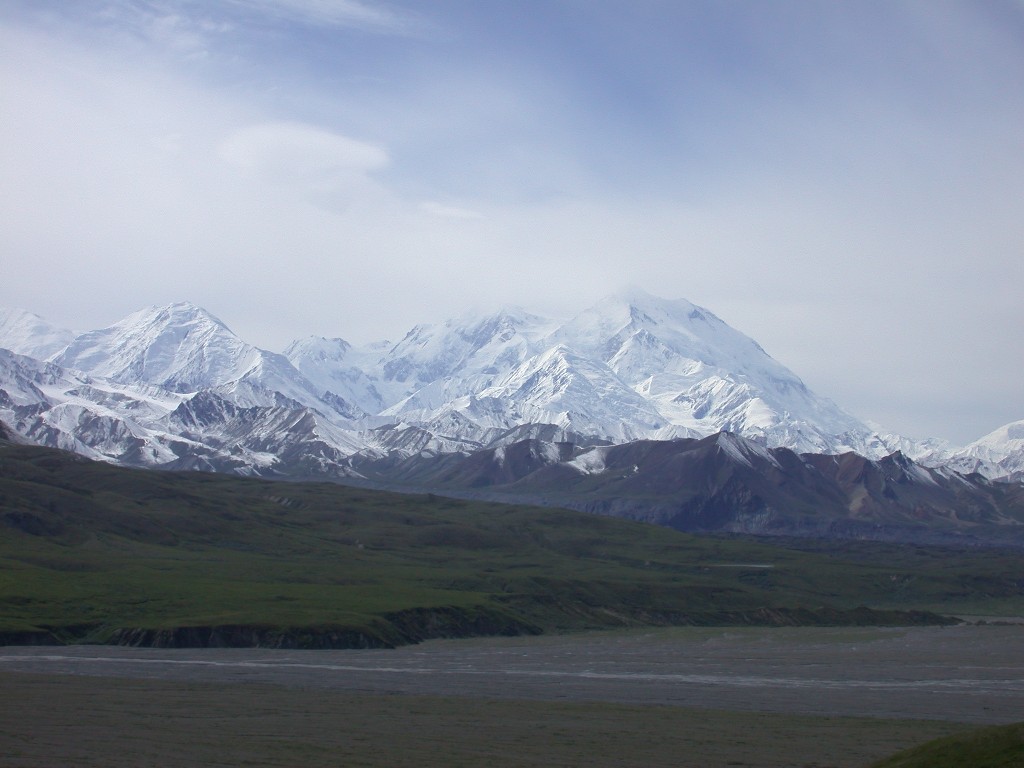
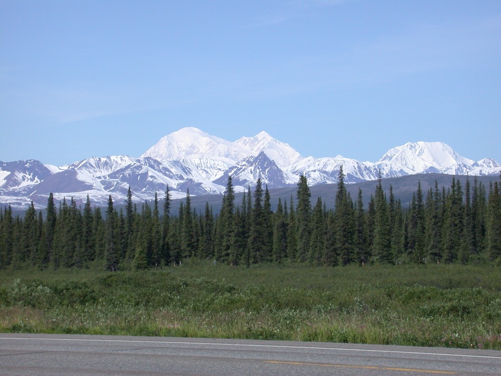
We finally got our first look at Mt. McKinley (Denali) and Dave pulled over to let us take a look. We are lucking out, the clouds cleared and we are able to see the great mountain. It was 70 miles away when we got this first look. We crossed the Savage River. As soon as you cross the river, there is a small ranger station and the road narrows and becomes gravel. This is as far as you can go in a car. The only way to see more of the park is on the buses.
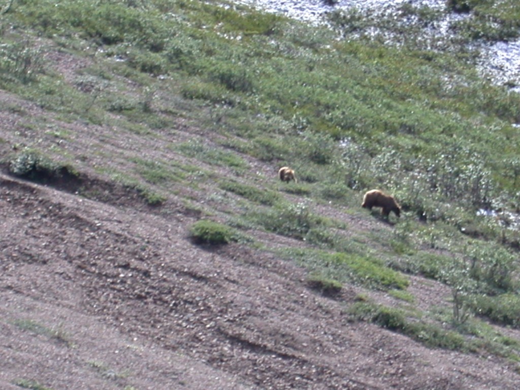
We were all enjoying the beautiful views when Dave spotted an oncoming bus pulled over to the side not far ahead of us. When we got to the spot where they were, we were able to see why they had stopped. On the opposite side of the creek on the hillside was a Grizzly sow and a 2nd year cub. They were grazing on plants. We were able to watch them for quite about 15 minutes. They were too far away for good photos, but we could see quite well with binoculars. It was a thrill for all of us.
We stopped for a rest break at Teldanilca and walked to the top of the hill. The views were just amazing. It was turning into a wonderful day.
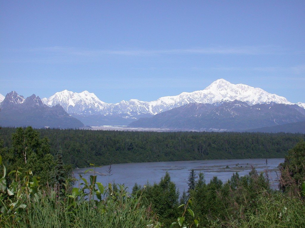
After reboarding the bus, we saw caribou and marmots. Our trip terminated at Eielson Visitor's Center, and we all got off for a look at Mt. McKinley. It was amazing and was still 30 miles away! At 20,000’, it is the highest mountain on the North American Continent. The chance of seeing all of it without cloud cover in the summer is 20-30% and we were seeing it all! As there is no food available in the Park, we had out picnic lunch while at visitors center. After lunch we looked at the displays in the visitors center. Then someone said they could see bears so we headed over to the observation deck and looked for them. On the opposite hillside were a sow and 3 first year cubs. It was fun watching them and we were sorry when it was time to go. The little cubs were wandering around and playing with each other, mom would have to go and round them up every so often. They were still to far away for pictures. Sorry.
The bus ride back to the Park entrance followed the same route and we saw a lot more caribou and ground squirrels. We were disappointed not to see any wolves or foxes, but glad we had seen the bears. We had left this morning thinking it was not going to be a good day due to the overcast skies but it really turned out fantastic and we were blessed to have fantastic views of “the mountain”. It was a long day and we were tired.
July 18 – The sun is out again today. We drove back over to the National Park and drove out to Savage River in the truck. We saw some more Ptarmigan and got another look at “the mountain”, which was even clearer today than yesterday. What luck we are having!
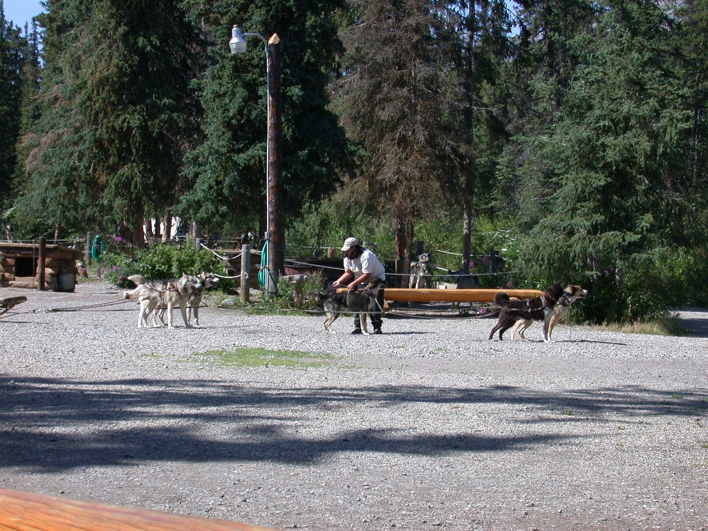
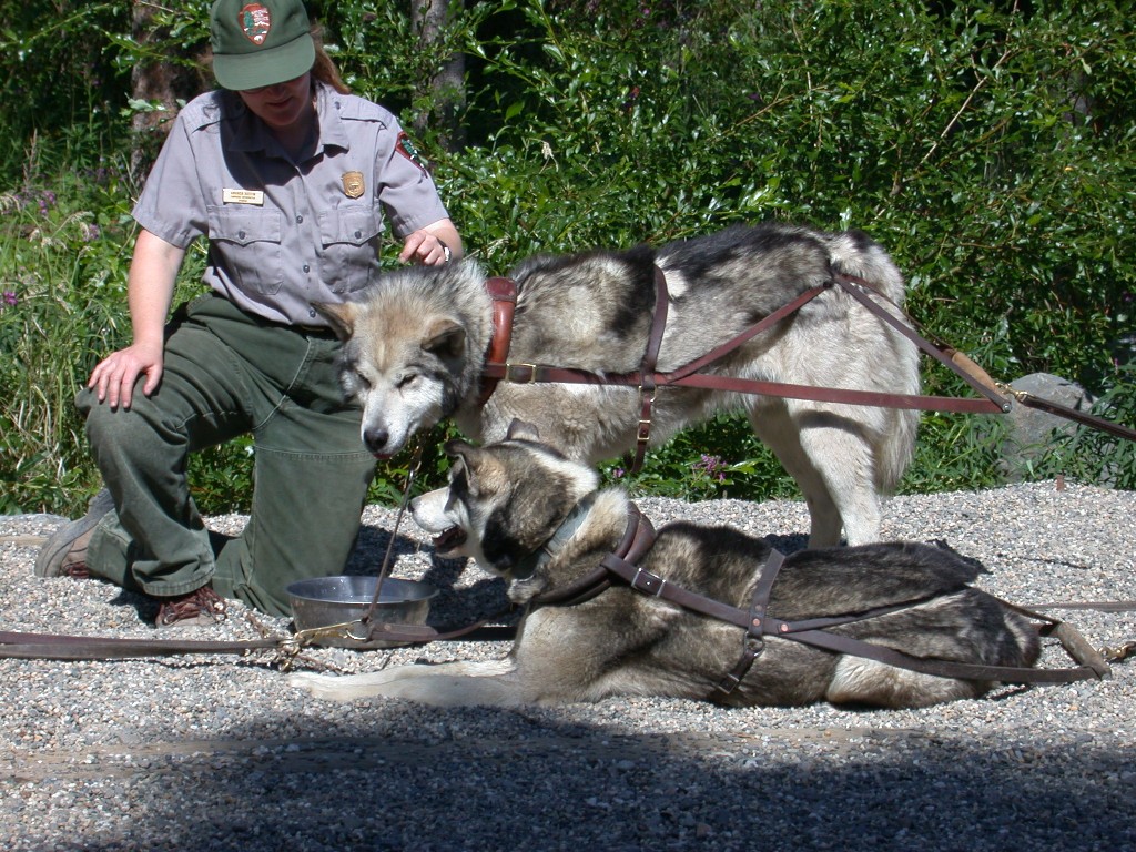
After returning to the Visitors Center we parked and headed to the bus boarding area to catch the bus for the sled dog exhibition. Denali National Park has the only sled dog kennels in the National Park Service. The dogs and sleds have proven to be the best method for getting into the park during the winter.
We got off the bus and walked down the park to the kennels. The dogs were very excited to see everyone. Sled dogs are very people oriented and get quite excited when they get company. We walked around the kennels, meeting and petting the dogs. There was one litter of puppies, but they were in the doghouse napping and refused to come out.
We were then directed to the viewing area stands and watched as a team of dogs was harnessed to a sled with wheels. They gave us and demo on a short track and those dogs can really run. They become really excited when they see the sled and can hardly be contained as they are hitched up. After we watched the demo we were given information on the dogs, how they are used and how they are trained, etc. It was really interesting.
After the demonstration we boarded the bus and went back to the Visitors Center, picked up the truck and went back home to eat.
Following dinner we went back to the Visitors Center and attended a ranger program on wolves. It was an interesting and informative program. We then headed over to Riley Creek Campground where we attended a campfire program by a park volunteer. We were really tired by the time we got home and into bed.
July 19 – We were up early this morning and got
hitched up. It is a beautiful day as we head down the Parks Highway towards
We arrived at Palmer, AK and checked into the RV park. We decided to spend a couple of days at the park where we will be staying in late August when we meet Dick and Phyllis to go to the State Fair. After setting up we drove into Palmer to check out the Laundromat for tomorrow.
July 20 – We headed for the Laundromat this morning
and got the laundry out of the way. Then drove into
July 21 – We hitched up and headed south on the
Kenai Peninsula in rain. The road from
We arrived in Kenai in the afternoon and checked into Beluga Lookout RV Park. It was cool and overcast but the rain had finally quit. Spaces here are really tight! We had chosen this park because we were told it was a good place to see the Beluga Whales. It is on a bluff overlooking the mouth of the Kenai River and Cook Inlet. It was windy and cool so we didn’t go out on the bluff today.
We ran into town and got something to eat, then did some grocery shopping. Back home and watched some TV.
July 22 – Still overcast. From the peninsula you should be able to view 4 volcanoes, however it is cloudy and we are unable to see across Cook Inlet to see them. Maybe before we leave. Dick’s knee is bothering him so we decided to take a little jaunt in the truck. We drove north of Kenai to Captain Cook State Park and the end of the road. We parked at Bishop Creek and walked down to the beach. Bishop Creek is a Salmon spawning stream and we were hoping to see some of the fish going upstream. The only fish we saw were two that had been caught by a bear. He had eaten the belly and left the rest of the fish. We had read that after the bears glut themselves on fish, they only eat the belly of the ones they catch, for the roe. The opposite side of the bank was muddy and you could see the marks from the bear’s claws where he had slid down to the stream.
On the way back we went through the little village of Nikiski. This area is a big oil production area and there are several refineries located there. They have a large indoor swimming pool with a waterslide 136’ long.
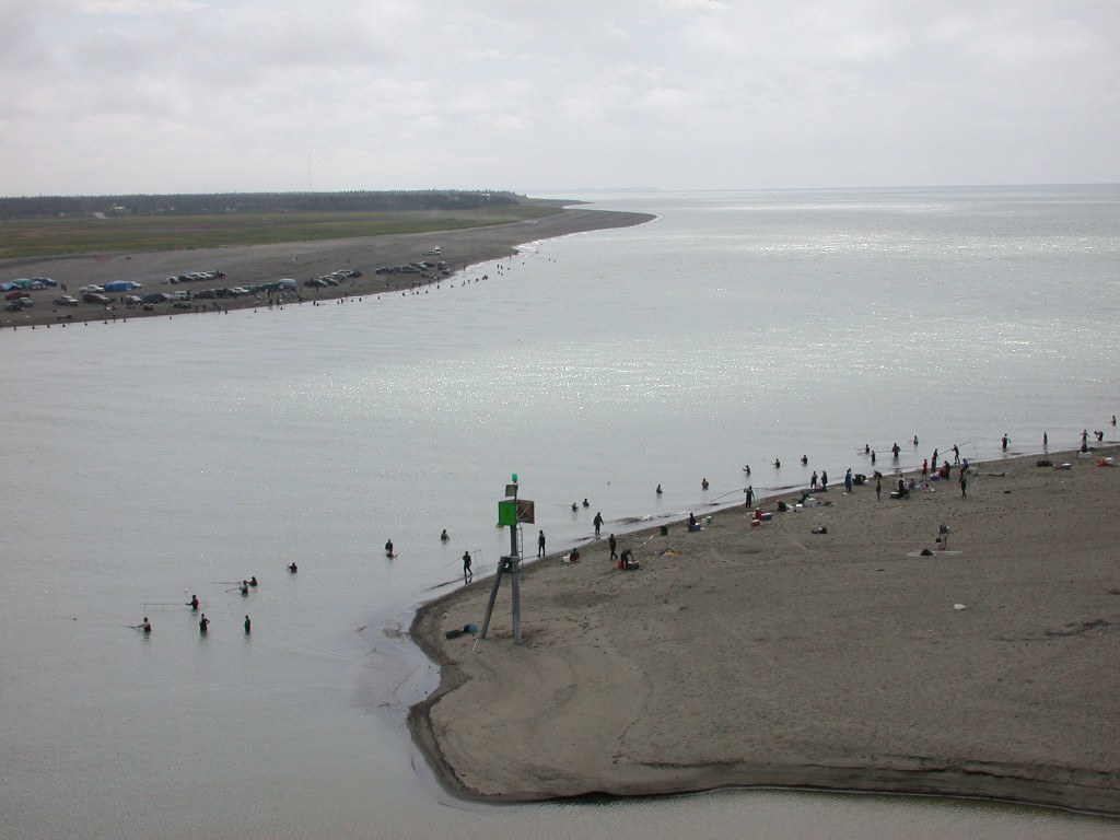
After dinner Millie walked out to the bluff in hopes of seeing the Beluga Whales. The dip netters were out in full force as it was near high tide and the Salmon use the tide to help save energy on their quest to the spawning areas. Dip netting is only allowed at certain times. The nets are very large, about 48” or so across, with a 6’ or so handle on them. The fishermen wade into the water, hold out the net as far as they can and hopefully the salmon will swim into the net. The whales also are seen near the mouth of the river during high tide. She did get a glimpse of a whale and also a seal, plus watched the Salmon leaping up the river.
July 23 - Somewhat
After dinner we walked out to the bluff to watch for whales. No luck this evening.
July 24 – It is raining today so we decided not to do much. Dick puttered on his computer and Millie drove into town to see about getting a hair cut. Millie visited the local quilt store and then found a place to get her haircut. They gave her an appointment for later in the day, so she went home for lunch.
After lunch Dick drove back in to town with Millie and dropped her off at the hair salon and went to the post office to pick up our mail.
July 25 – Moving day today. We got hitched up and headed south to Homer, on the tip of the Kenai Peninsula. The drive down was enjoyable and we got to our park and set up in the early afternoon. We spent the rest of the afternoon just hanging around the house. Our space is the last one towards the inlet, so we have a good view of the water, but still not able to see the volcanoes. They still have cloud cover.
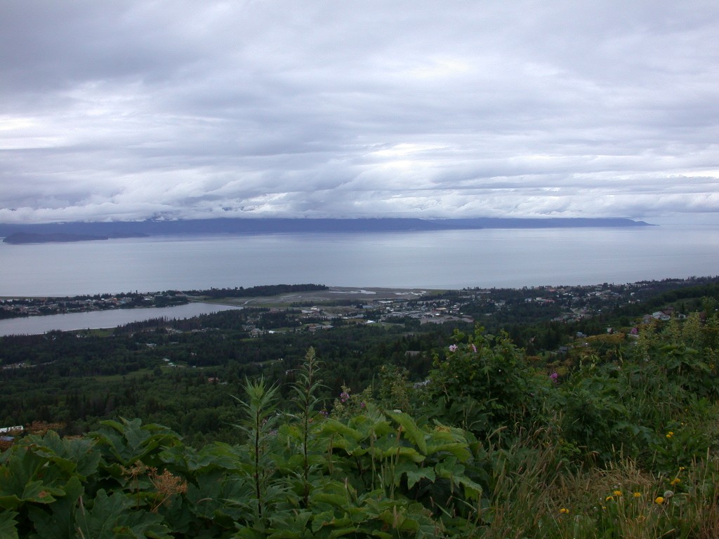
July 26 – Today we decided to check out Homer. We first drove up on the mountain on a road nicknamed the Skyline Drive. From there you have a beautiful view of the town, inlet and the Homer Spit. The spit is a narrow piece of land that extends out into the inlet about 5 miles. In one area it is only wide enough for a 2-lane road. The spit is the home to many tourist businesses and small boats. It was very crowded. There is also an area known as the Fishing Hole, which is “seeded” with Salmon smolt every year. This ensures that adult Salmon return to the Hole every year. Many people were fishing there. Homer is also a large Halibut fishing area.
We parked and walked along the spit for a while, peeking in the T-shirt and gift shops. Then we came back to town and looked around there for a while. We needed to drop some mail in the Post Office so we stopped and Millie ran in to drop the letter in the box. This Post Office has a beautiful round window in the front that is stained glass. The sun streaming through the glass lit it up beautifully and Millie couldn’t resist taking a picture. We went grocery shopping, then back to the RV and spent a quiet evening.
July 27 – The sun is out today and we drove back up the highway to check out a couple of the little towns we had passed through earlier in the week.
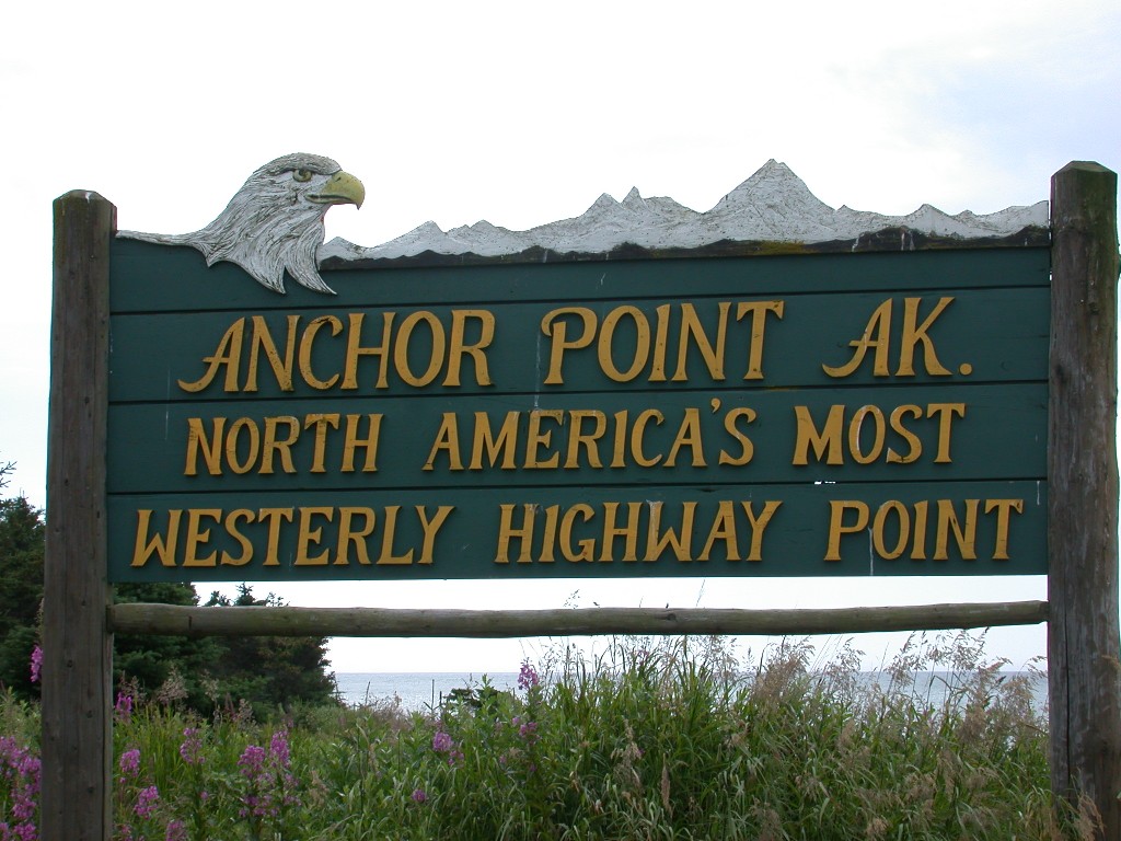
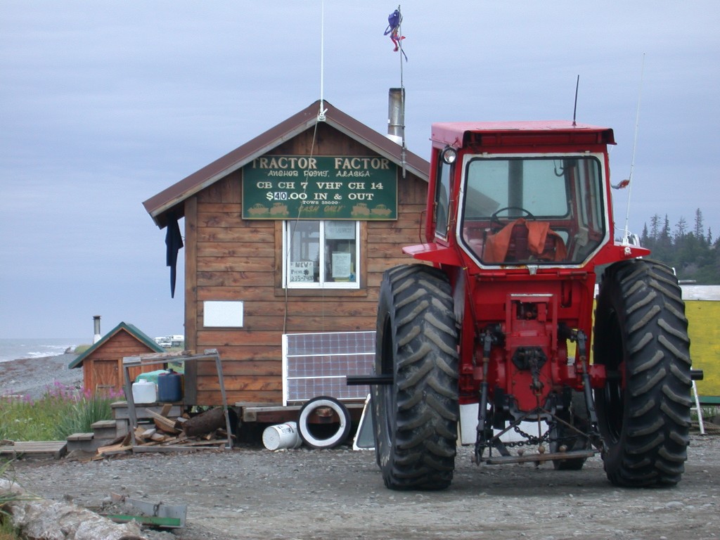
Anchor Point was our first destination. We drove west from town to the shore of Cook Inlet. There we were at the furthest point west in Continental US to which you can drive on a continuous highway system. We were hoping to see the tractor boat launch in action but the tide was in and the tractors were parked. Cook Inlet has very extreme tides and when the tide is low these large tractors are used to haul the boats out the water for launching.
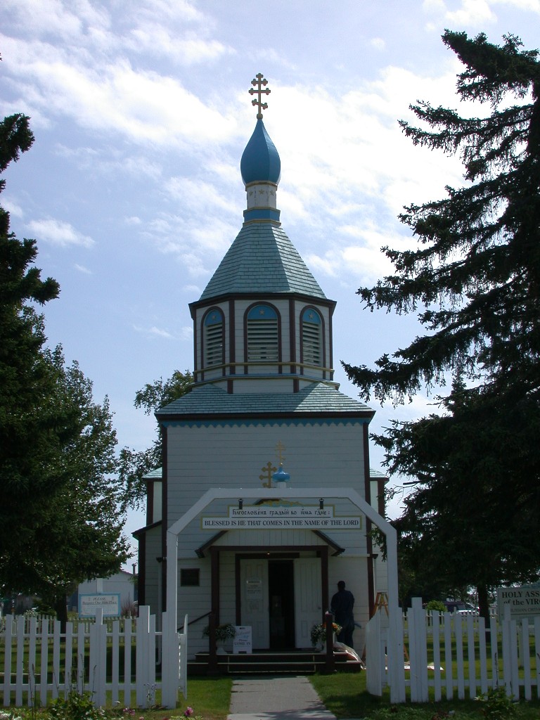
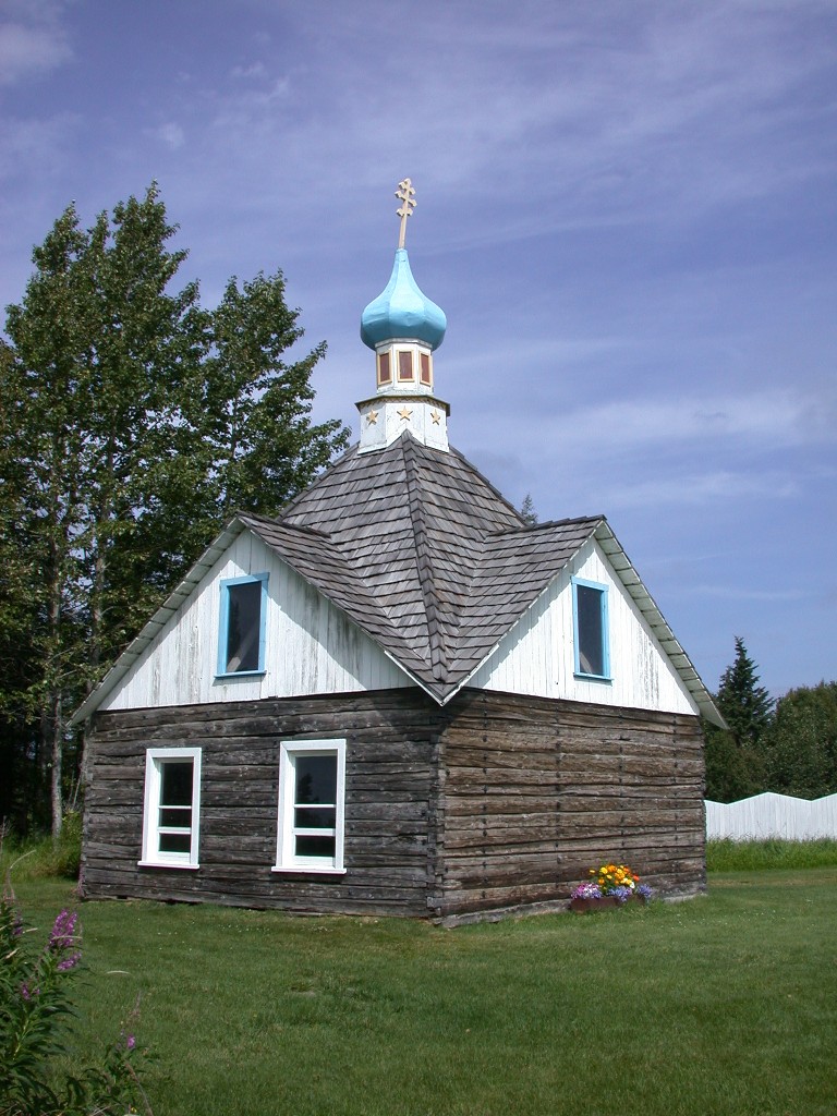
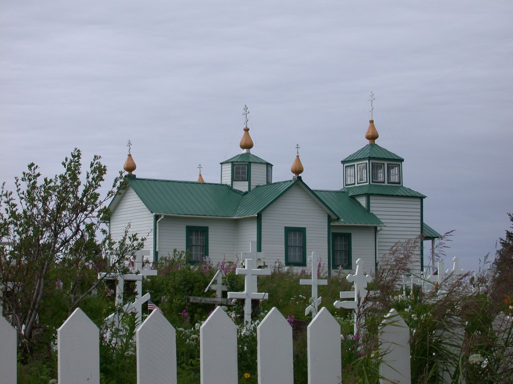
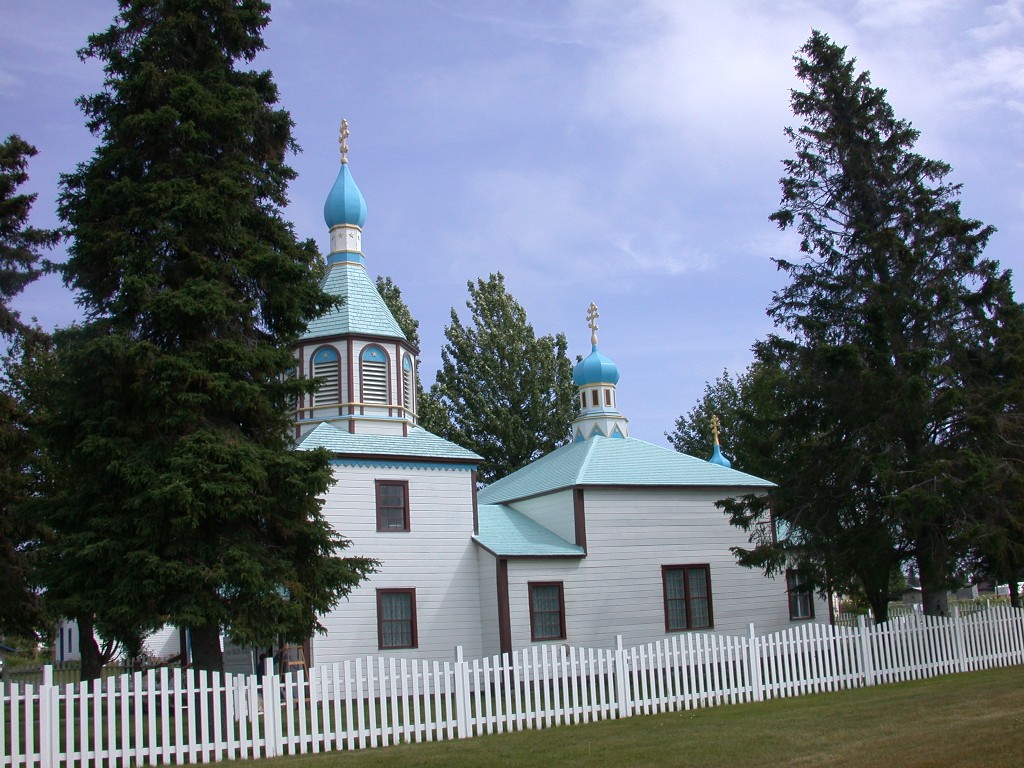
Our next stop was the little town of Ninilchik. We visited the little Russian Orthodox Church high on a bluff overlooking Cook Inlet and the old village. It was really a pretty little spot. This church has 5 onion domes; the one in Kenai has 3.
We next visited the beach area of Deep Creek State Park. We had seen a pretty little lighthouse from the highway and were looking for access to it. We were unable to get close, but did get a picture of it from the beach. There were also large tractors for boat launches on this beach.
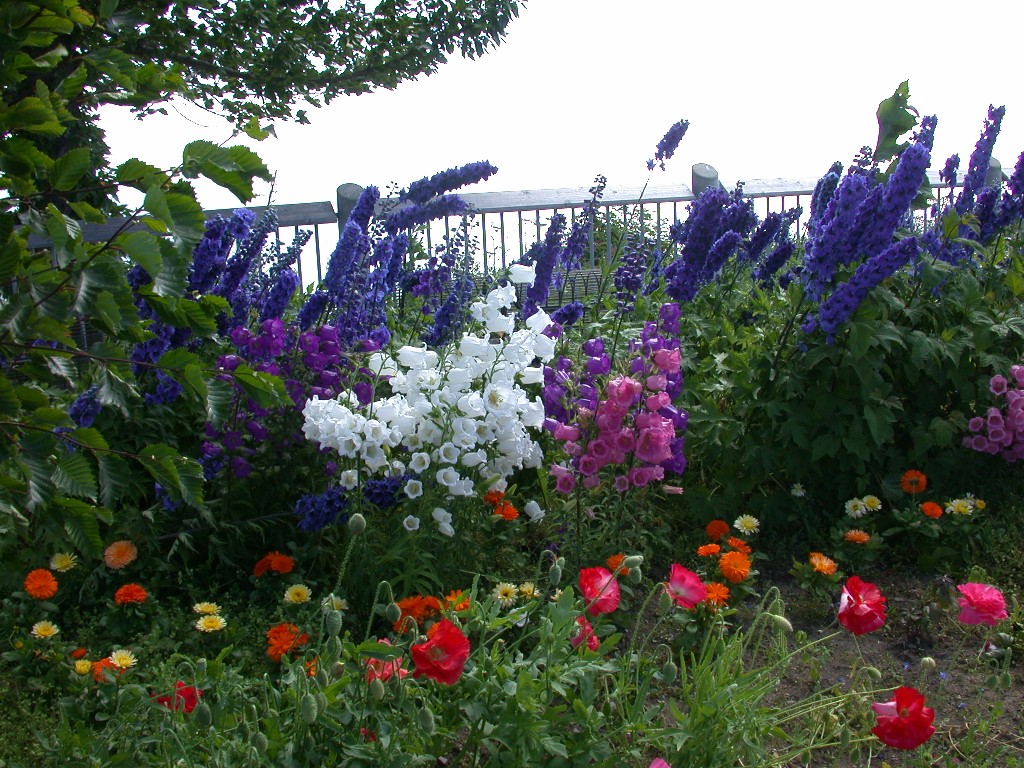
We stopped at a pretty viewing area just outside of Homer that had great views of the inlet. The city also has planted several areas with beautiful flowers. We are enjoying the beautiful floral displays we are seeing in Alaska. The flowers are large due to the long daylight hours.
We returned home and fixed dinner, then read the paper and watched TV.
July 28 – Monday, so we decided to get the laundry done. Drove into town to the local Laundromat and got that chore out of the way.
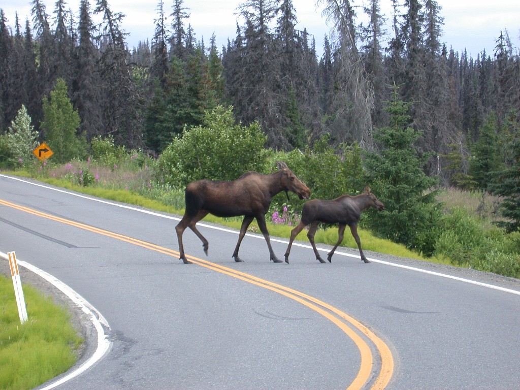
Millie had talked to Phyllis over the weekend and Phyllis told us to drive out the east side of Homer on East End Road, that the views were great. We drove out and were fortunate not only to see some great views of Homer, but we also saw a Moose cow and calf who were willing to let us get some photos. It was a great drive and when we got to the bluff area at the terminus we parked and walked down a very steep, winding, narrow lane that went down to the beach. There were some very pretty flowers along the way. We only walked part way down as Dick is still having discomfort with his knee even though he is wearing his brace.
Back home, we fixed dinner. After cleaning up the kitchen, Millie walked down to the beach area. The tide was out and you could walk out quite a distance on the flats. She walked for a while enjoying the scenery. As she was starting back towards the park a Bald Eagle landed on one of the rocks by the shore. It is still a thrill to see these marvelous birds.
Tomorrow we will be heading to the other side of the peninsula to Seward.
July 29 – It looks like we are going to have a
travel day without rain. We got packed up and headed north towards Soldatna
where we will pick up the Seward Highway and head south to Seward. The weather
was
We arrived at the Bear Creek RV Park, where we had reservations, and got set up. We have a large space here where we can put out our awning and not be crowded.
We drove into town to check everything out. Seward is on the east side of the Kenai Peninsula on Resurrection Bay. During the great 1964 earthquake much of Seward was destroyed, including the entire waterfront that slid into the bay. There were some large tank farms here and when the tanks ruptured, the fuel spilled into the bay and caught fire. The bay and part of the town burned for several days. This quake was the largest ever recorded in North America, a 9.2.
The city rebuilt and this year is celebrating their 100th Anniversary. It is a busy little seaside town with lots of shops and a large small boat harbor.
We found a place to park and walked around, checking out some of the gift shops at the harbor, then finding us a place to have dinner. After dinner we headed back to the RV for a quiet evening.
July 30 – We had decided that we would take a Wildlife and Glacier Cruise while we were in Seward, so we were going to book it today. We watched the weather report to see if we could determine which day would be best, then looked at the flyers we had on the various cruise offerings. We narrowed it down to 2, but then were having trouble deciding which one. Dick decided that we might as well try them both, as they were each somewhat different in route.
We went into town and booked our cruises. We will be going on one on Friday and one on Saturday. Those were the two best days for good weather as far as the forecast went.
We then went to the Alaska Sealife Center. This beautiful facility is a direct result of the Exxon Valdeez Oil Spill. A temporary rehabilitation facility was set up here to help with the wildlife that was affected by the spill. A 7-acre waterfront site was built to combine research, rehabilitation and education facilities using funds from the Exxon Valdeez Restoration Fund and private donations.
We enjoyed many exhibits in the center, including sea lion, harbor seal and sea birds. The giant octopus in his tank was really impressive. We also attended a film presentation and a talk given by a National Park Ranger. After our visit, we went back to the RV park for dinner and a quiet evening.
July 31 – The sun is out today, it’s going to be a
good day to be outside. Our first stop is
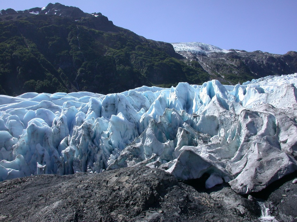
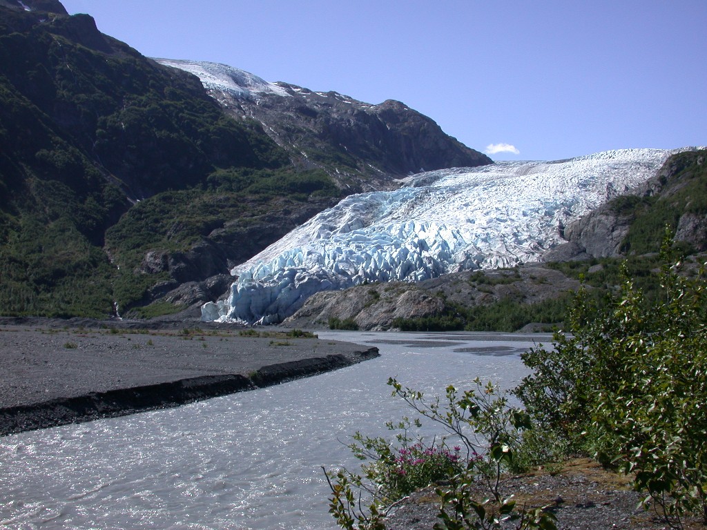
Exit Glacier. This glacier is part
of the Kenai Fjords National Park and can be accessed by foot. The drive out to
the glacier followed along the Resurrection River and had some
After viewing the glacier we walked the interpretive trail back to the parking area. It was a beautiful sunny day and we enjoyed our 2 hours at Exit Glacier.